Machadinho River
Appearance
| Machadinho River | |
|---|---|
| Native name | Rio Machadinho (Portuguese) |
| Location | |
| Country | Brazil |
| Physical characteristics | |
| Mouth | |
• location | Jiparaná River, Campos Amazônicos National Park |
• coordinates | 9°01′39″S 61°47′42″W / 9.027549°S 61.795104°W |
| Basin features | |
| River system | Jiparaná River |
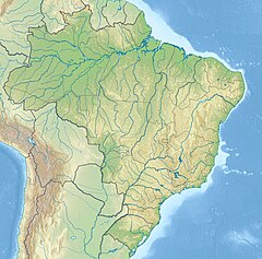
The Machadinho River (Portuguese: Rio Machadinho) is a river of Rondônia state in western Brazil, a tributary of the Jiparaná River.
The river runs along the western boundary of the 537 hectares (1,330 acres) Seringueira Extractive Reserve, one of a number of small sustainable use units in the region whose primary product is rubber.[1]
See also
[edit]References
[edit]- ^ RESEX Seringueira (in Portuguese), ISA: Instituto Socioambiental, retrieved 2016-06-07

