Mäçkärä
Mäçkärä
Мәчкәрә | |
|---|---|
Selo | |
| Coordinates: 56°20′24″N 50°49′52″E / 56.340006°N 50.831125°E | |
| Country | Russia |
| Region | Tatarstan |
| District | Kukmara District |
| Time zone | UTC+3:00 |
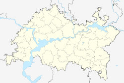
Mäçkärä (Tatar: Мәчкәрә, romanized: Mäçkärä, Russian: Маскара, romanized: Maskara) is a rural locality (a selo) in Kukmara District, Tatarstan. The population was 229 as of 2010.[1]
Geography
[edit]Mäçkärä is located 25 km north of Kukmara, district's administrative centre, and 163 km northeast of Qazan, republic's capital, by road.[1][2]
History
[edit]The earliest known record of the settlement dates from 1715.[1] In 18th and the beginning of 19th century village was for its madrasa, which was well-known in Idel-Ural region.[3] The population of Mäçkärä reached its peak of about 1000 inhabitants in 1905.
Before the creation of Tatar ASSR in 1920 was a part of Malmış Uyezd of Wätke Governorate. Since 1920 was a part of Arça Canton; after creation of districts in Tatar ASSR (Tatarstan) in Kukmara (1930–1963), Saba (1963–1965) and Kukmara districts.[1]
Notable objects
[edit]References
[edit]- ^ a b c d "Мәчкәрә". tatarica.org (in Tatar). Retrieved 7 August 2022.
- ^ "Маршрут: село Маскара (Кукморский район, Республика Татарстан) - Казань (Республика Татарстан): расстояние и время в пути на карте - 150 км, 2 часа 44 минуты". Retrieved 9 April 2023.
- ^ Ислам в Татарстане: энциклопедический словарь (in Russian). Moscow: Медина. 2017. ISBN 9785975601391.
External links
[edit]- "Мәчкәрә". tatarica.org (in Tatar). Retrieved 7 August 2022.

