Logan City
| City of Logan Queensland | |||||||||||||||
|---|---|---|---|---|---|---|---|---|---|---|---|---|---|---|---|
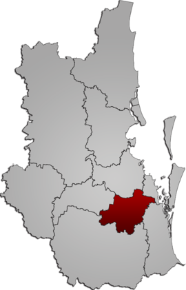 Location within South East Queensland | |||||||||||||||
 | |||||||||||||||
| Population | 345,098 (2021 census)[1] (7th) | ||||||||||||||
| • Density | 360.23/km2 (933.0/sq mi) | ||||||||||||||
| Established | 1978 | ||||||||||||||
| Area | 958 km2 (369.9 sq mi)[2] | ||||||||||||||
| Mayor | Jon Raven | ||||||||||||||
| Council seat | Logan Central | ||||||||||||||
| Region | South East Queensland | ||||||||||||||
| State electorate(s) | Algester*, Jordan, Logan, Macalister, Scenic Rim*, Springwood*, Stretton*, Waterford, Woodridge | ||||||||||||||
| Federal division(s) | Rankin, Forde, Wright | ||||||||||||||
| Website | City of Logan | ||||||||||||||
| |||||||||||||||
The City of Logan[3] is a local government area (LGA) located in the south of Greater Brisbane in South East Queensland (SEQ), Australia. Situated between the City of Brisbane to the north and the City of Gold Coast to the south, the City of Logan also borders the Scenic Rim Region, the City of Ipswich, and Redland City LGAs. Logan is divided into 70 suburbs and 12 divisions; a councillor is elected to each of the latter.[4] The council had a population of 326,615 as of June 2018.[2]
Gaining significant area in 2008 from the amalgamation of parts of the Albert and Beaudesert Shires, the City of Logan extends north to Priestdale, south to Mundoolun near the Albert River, east to Carbrook at the Logan River, and west to Lyons. Logan is located across parts of the sub-basin of Oxley Creek, and the Logan and Albert Rivers. The Daisy Hill Koala Centre serves as an example of Logan's prominent bushland, reminiscent of Karawatha Forest, and the Tamborine and Venman Bushland National Parks, that border Logan suburbs.
The region is named after Captain Patrick Logan, as is the aforementioned river, alongside the commercial hubs of Logan Central, Shailer Park's Logan Hyperdome, and Browns Plains. Other populous suburbs include Beenleigh, Rochedale South, Meadowbrook, Springwood, Woodridge, Eagleby and the rural towns of Jimboomba and Logan Village. The city facilitates much of the transport between Brisbane and the Gold Coast. Its motorway network is extensive: in the city's north-east, the Logan Motorway joins the Pacific Motorway, while the Mount Lindesay Highway and Sydney–Brisbane rail corridor cross the city along a roughly central north-south axis. New developments are common, particularly those being built at Yarrabilba and Greater Flagstone, while Griffith University has already established a Logan campus in Meadowbrook which is being developed into a specialist area based around health, research and education.[5]
In 2016, Luke Smith was elected mayor of Logan.[6] On 2 May 2019, Minister for Local Government Stirling Hinchliffe sacked the Logan City Council after eight of its Councillors and suspended mayor were charged with one count of fraud. The suspended Mayor was also charged with two counts of misconduct. The council was under administration until March 2020 elections.[7][8]
In the 2021 census, the City of Logan had a population of 345,098 people.[1]
History
[edit]
Yugembah (also known as Yugumbir, Jugambel, Jugambeir, Jugumbir, Jukam, Jukamba) is an Australian Aboriginal languages of South East Queensland. The Yugembah language areas include Gold Coast, Logan, Scenic Rim, Tweed River Valley, Albert River, Beaudesert, Beenleigh, Coolangatta, Coomera, Logan River, Pimpama and Tamborine, within the local government boundaries of the City of Gold Coast, City of Logan, Scenic Rim Regional Council and the Tweed River Valley.[9]
The Commandant of the Moreton Bay Penal Settlement, Captain Patrick Logan, was a compulsive explorer and in 1826 on his first expedition he discovered the Logan River. He noted the river was well suited to large-vessel traffic and was a first-class avenue to access the high-quality arable land along its banks. He named the country Darling, in honour of the Governor. The Governor renamed the river after Logan. One of the first large employers was the timber industry.[10] The Logan River served as a rafting ground for logs and the new railways spurred local demand.[10]
The penal settlement based in Brisbane was closed in 1841 and the land was quickly taken up by squatters. The first leases of land in the Logan area were issued from 1849 and immigration was encouraged following the separation from NSW in 1859. The declaration of the Logan and Eight Mile Plains Agricultural Reserves in 1862 led to extensive settlement of the area. German immigrants arrived in batches from the 1864 onwards. Generous land orders for immigrants in Queensland created a drawcard in the possibility of owning their own farm.[11]
A cotton gin, which was converted to a sugar mill, was built at Loganholme in 1867.[11] Cotton growers faced problems with both the weather and a lack of available labour despite the introduction of Kanaka labour. By the 1870s few working cotton plantations remained along the Logan River.[11] While this crop was marginally successful, between 1866 and 1874, sugar was soon to become the staple industry.
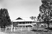
Many small sugar mills were started by farmers seeking to avoid processing costs charged by big mills. However these quickly proved to be uneconomic. Many farmers in the area abandoned sugar after a severe frost in 1885 and a catastrophic flood in 1887 which saw crops destroyed and covered with metres of silt. Others continued growing sugar cane to make 1890 one of the best harvests ever.[11] In 1888, the railway opened in Logan.[12] Within a year, Cobb and Co services ended in Logan.[12]
Significant flooding occurred in Logan during the 1974 Brisbane flood.[13] The Wild Water Water Slide Park began operations in October 1982. The site was to become the Logan Hyperdome with the first work on the regional shopping centre beginning in October 1988.[14] It was officially opened in July 1989. Construction work on the Logan Hospital started in February 1989.[14] In August 2011, the Logan suburb of Slacks Creek was the location for Queensland's worst house fire.[15]
In 2017, a water treatment plant at Round Mountain became the first in Australia to be powered entirely off-grid.[16]
Establishment of Logan
[edit]
The Department of Local Government instigated the formation of the new Logan Shire, which included the northern suburbs of both Albert and Beaudesert Shires. A section in the north previously belonged to the Shire of Tingalpa. There were about 69,000 people living to the north of the Logan River. On 31 May 1978 Local Government Minister Russ Hinze introduced the Local Government (Adjustment of Boundaries) Bill and which was officially approved on 8 June 1978. Logan then was declared a city on 1 January 1981[14] and the administration building on Wembley Road was opened in February 1981.
The city was named after Captain Patrick Logan, one of the founders of the Moreton Bay convict settlement. Logan was honoured in the names of many locales in the district, such as the Logan River, the suburbs of Loganlea, Logan Village, Loganholme, Logan Reserve and Logan Central, the Logan Motorway and Logan Road, which connects Logan City with the nearby state capital of Brisbane.
Local government changes
[edit]With the major changes to local government in Queensland which took effect at 15 March 2008 local elections, Logan more than tripled in area and added 78,400 people to its population. This came about through annexing a large section of the now-dissolved Shire of Beaudesert as well as the Beenleigh-Eagleby suburban area to its southeast, which had been part of the Gold Coast. Residents of Beenleigh and Eagleby were asked to vote to join Logan, with an overwhelming "No" vote. Despite this, the amalgamation went ahead. In its rationale for the changes, the Local Government Reform Commission argued that the area added brought the South East Queensland urban footprint and future growth areas to 2026 under the one local government, which could plan effectively for the area's future and would face reduced compliance costs for development works. Economic factors, the lack of geographic barriers and the presence of transport corridors were also considered to be favourable to the annexation. Consideration was given to a merger with Redland to its east, but geographical barriers and the lack of a community of interest between them militated against this.[17]
Demographics
[edit]The area is a major regional growth and development corridor with significant population growth expected through to 2041, second only to Brisbane in the state.[18] The city has a higher rate of multicultural diversity than the Queensland average.[19] About one quarter of Logan's residents were born overseas.[19]
In the 2016 census, Logan City had a population of 303,386 people, 50.6% female and 49.4% male with 3.2% being Indigenous Australian. The median age of Logan City was 34 years old, 4 years below the national median of 38. The most commonly nominated ancestries were English (26.7%), Australian (24.0%), Irish (6.9%), Scottish (6.5%), and German (3.9%). 65.8% of people living in Logan City were born in Australia. The other top responses for country of birth were New Zealand (7.7%), England (3.8%), the Philippines (1.0%), India (0.9%), and Samoa (0.7%). 77.8% of people spoke only English at home; the next most common languages were Samoan (1.4%), Mandarin (1.0%), Arabic and Hindi (0.7% each), and Spanish (0.5%). The most common religious affiliations reported were none (28.9%), Catholic (18.5%), Anglican (14.1%), and Uniting Church (4.2%).[20] It had an unemployment rate of 5.61%, lower than the Queensland average of 6.2%.[21]
In the 2021 census, the Logan City had a population of 345,098 people, 50.6% female and 49.4% male with 4.2% being Indigenous Australian. The median age of Logan City was 34 years old, 4 years below the national median of 38. The most commonly nominated ancestries were English (35.5%), Australian (31.1%), Scottish (8.2%), Irish (8.0%) and German (4.8%). 65.7% of people living in Logan City were born in Australia. The other top responses for country of birth were New Zealand (7.1%), England (3.3%), India (1.6%), Philippines (1.1%) and Samoa (0.7%). 75.1% of people spoke only English at home; the next most common languages were Samoan (1.3%), Punjabi (1.2%), Mandarin (1.1%), Arabic (0.8%) and Hindi (0.7%). The most common religious affiliations reported were none (40.3%), Catholic (14.8%), Anglican (9.3%) and Christian (4.3%).[1]
Governance
[edit]
At the federal level, the majority of the city's population is represented by the electorate of Rankin.[22] First proclaimed in 1984, Rankin has elected a member of the Labor Party at every election since inception.[23] The newer parts of Logan are within Forde, while Moreton and Oxley contain small portions of Logan City closer to Brisbane. The Division of Wright, created in 2010, contains many of the rural areas in the southern part of the city.
Council
[edit]Logan City Council is divided and consists of 12 councillors[24] and a popularly elected mayor.[25] Councillors are not officially endorsed by political parties, but are required to declare current memberships of political parties, bodies, associations and trade or professional organisations.
| Councillor | Declared political membership | Term | Constituency | |
|---|---|---|---|---|
| Cr. Jon Raven | ALP | 2024–current | Mayor | [26] |
| Cr. Lisa Bradley | Independent | 2008–2019, 2020–current | Division 1 | [26] |
| Cr. Teresa Lane | ALP | 2020–current | Division 2 | [26] |
| Cr. Melinda Russell | ALP | 2020–current | Division 3 | [26] |
| Cr. Nathan St Ledger | Independent | 2024–current | Division 4 | [26] |
| Cr. Paul Jackson | Independent | 2024–current | Division 5 | [26] |
| Cr. Anthony Hall | Independent | 2020–current | Division 6 | [26] |
| Cr. Timothy Frazer | ALP | 2020–current | Division 7 | [26] |
| Cr. Jacob Heremaia | LNP | 2020–current | Division 8 | [26] |
| Cr. Scott Bannan | Independent | 2020–current | Division 9 | [26] |
| Cr. Miriam Stemp | Independent | 2020–current | Division 10 | [26] |
| Cr. Natalie Willcocks | Independent | 2020–current | Division 11 | [26] |
| Cr. Karen Murphy | Independent | 2020–current | Division 12 | [26] |
The council administers local infrastructure including 6 public pools, more than 900 parks, 7 cemeteries and a waste treatment plant at Browns Plains that provides gas-powered cogeneration power to about 2,000 homes.[27]
Election results
[edit]Division 1
[edit]| Party | Candidate | Votes | % | ±% | |
|---|---|---|---|---|---|
| Independent | Lisa Bradley | 8,140 | 58.36 | −21.79 | |
| Independent | Peta Duffy | 3,289 | 23.58 | +23.58 | |
| Independent | Alex Fisher | 2,520 | 18.07 | +18.07 | |
| Total formal votes | 14,178 | 96.20 | |||
| Informal votes | 560 | 3.80 | |||
| Turnout | 14,504 | ||||
| Independent hold | Swing | −21.79 | |||
Division 2
[edit]| Party | Candidate | Votes | % | ±% | |
|---|---|---|---|---|---|
| Independent Labor | Teresa Lane | 7,605 | 60.52 | ||
| Independent | Reese Preston-Smith | 3,085 | 24.55 | ||
| Independent | Jacinta Paper | 1,876 | 14.93 | ||
| Total formal votes | 12,566 | 93.07 | |||
| Informal votes | 935 | 6.93 | |||
| Turnout | 13,501 | ||||
| Independent Labor hold | Swing | ||||
Division 3
[edit]| Party | Candidate | Votes | % | ±% | |
|---|---|---|---|---|---|
| Independent Labor | Mindy Russell | 11,108 | 84.16 | ||
| Independent | Kahil Evens | 2,091 | 15.84 | ||
| Total formal votes | 13,199 | 95.83 | |||
| Informal votes | 639 | 4.62 | |||
| Turnout | 13,838 | ||||
| Independent Labor hold | Swing | ||||
Division 4
[edit]| Party | Candidate | Votes | % | ±% | |
|---|---|---|---|---|---|
| Independent | Nathan St Ledger | 6,430 | 45.60 | +45.60 | |
| Independent | Lucy Reilly | 4,110 | 29.14 | +29.14 | |
| Independent Labor | Joshua Lucey | 3,562 | 25.26 | +25.26 | |
| Total formal votes | 14,102 | 94.97 | |||
| Informal votes | 747 | 5.03 | |||
| Turnout | 14,849 | ||||
| Independent gain from Independent | Swing | ||||
- Incumbent Councillor Laurie Koranski (Independent) did not recontest
Division 5
[edit]| Party | Candidate | Votes | % | ±% | |
|---|---|---|---|---|---|
| Independent | Paul Jackson | 5,301 | 42.91 | +42.91 | |
| Independent Labor | Sovannary UK | 4,296 | 34.77 | +34.77 | |
| Independent | Zoe McDonnell | 2,758 | 22.32 | +22.32 | |
| Total formal votes | 12,355 | 93.70 | |||
| Informal votes | 830 | 6.30 | |||
| Turnout | 13,185 | ||||
| Independent gain from Independent Labor | Swing | ||||
- Incumbent Councillor Jon Raven (Independent Labor) did not recontest in order to run for Mayor
Division 6
[edit]| Party | Candidate | Votes | % | ±% | |
|---|---|---|---|---|---|
| Independent | Tony Hall | unopposed | |||
| Independent hold | Swing | N/A | |||
Division 7
[edit]| Party | Candidate | Votes | % | ±% | |
|---|---|---|---|---|---|
| Independent Labor | Tim Frazer | 8,471 | 62.26 | ||
| Independent | Anthony Shorten | 5,135 | 37.74 | ||
| Total formal votes | 13,606 | 94.35 | |||
| Informal votes | 815 | 5.65 | |||
| Turnout | 14,421 | ||||
| Independent Labor hold | Swing | ||||
Division 8
[edit]| Party | Candidate | Votes | % | ±% | |
|---|---|---|---|---|---|
| Independent | Jacob Heremaia | unopposed | |||
| Independent hold | Swing | N/A | |||
Division 9
[edit]| Party | Candidate | Votes | % | ±% | |
|---|---|---|---|---|---|
| Independent | Scott Bannan | unopposed | |||
| Independent hold | Swing | N/A | |||
Division 10
[edit]| Party | Candidate | Votes | % | ±% | |
|---|---|---|---|---|---|
| Independent | Miriam Stemp | unopposed | |||
| Independent hold | Swing | N/A | |||
Division 11
[edit]| Party | Candidate | Votes | % | ±% | |
|---|---|---|---|---|---|
| Independent | Natalie Willcocks | unopposed | |||
| Independent hold | Swing | N/A | |||
Division 12
[edit]| Party | Candidate | Votes | % | ±% | |
|---|---|---|---|---|---|
| Independent | Karen Murphy | 6,975 | 51.34 | ||
| Independent | Nate Hamon | 6,612 | 48.66 | ||
| Total formal votes | 13,587 | 94.74 | |||
| Informal votes | 754 | 5.26 | |||
| Turnout | 14,341 | ||||
| Independent hold | Swing | ||||
Education
[edit]

Logan Reserve State School opened on 1 January 1868 and caters for students from Prep to Year 6 School with a C&K Kindy on site.[28][29][30] Another of the earliest schools in the area was Waterford State School. It was established as the Logan Provisional School and opened on 29 June 1869.[31] Logan Village State School caters for students from Prep to Year six and opened in March 1872.[32] The Centre Education Programme caters for students from Year 7 to Year 12. Loganholme State School opened 25 May 1873.[33][30] Park Ridge State School opened on 23 April 1895.[30]
Woodridge State School opened on 20 May 1924.[30] Woodridge North State School opened on 23 January 1967.[30] Logan City Special School caters for students from Early Childhood to Year twelve.[34] It opened on 1 January 1972.[30]
Woodridge State High School caters for students from Year seven to Year twelve. It opened on 1 February 1972.[30] Berrinba East State School opened on 24 January 1978.[35] Kingston College (originally Kingston State High School) was opened in 1978. It now caters for seven to year twelve and a continuing education campus. Marsden State school opened on 23 January 1978.[30]
Shailer Park State High School caters for students from Year seven to Year twelve. It opened on 29 January 1980.[30] Loganlea State High School caters for students from Year seven to Year twelve.[36] It opened on 27 January 1981.[30] Shailer Park State School opened on 25 January 1982.[30] Browns Plains State School opened on 24 January 1983.[30] Browns Plains State High School caters for students from Year seven to Year twelve. It opened 29 January 1985.[30] Marsden State High School caters for students from Year seven to Year twelve. It opened on 27 January 1987.[30]
Park Ridge State High School caters for students from Year seven to Year twelve. It opened on 29 January 1991.[30] Yarrabilba State School opened on 22 January 2018.[37]
Industry
[edit]There are extensive industrial and commercial areas, mostly in the north and east of Woodridge, and west of Springwood and Daisy Hill, clustered in the triangle formed by Logan Road/Pacific Highway and Kingston Road, and extending west along Compton Road. The Crestmead industrial estate is designed for light to medium industry in the manufacturing sector.[38]
Logan is Queensland's poker machine 'pokie' capital with over 2,128 machines in 41 registered sites. Per machine, each pokie pays out $5,886 which is the highest figure in the state.[39]
Australia's oldest continuously operating rum distillery is located at Beenleigh. Tourism is emerging as a significant contributor to the local economy with an increasing portfolio of cultural and sporting events.
Transport
[edit]
Logan City is serviced by Queensland Rail's Beenleigh and Gold Coast railway lines. The stations are Trinder Park, Woodridge, Kingston, Loganlea, Bethania, Edens Landing, Holmview and Beenleigh although Gold Coast trains stop only at Beenleigh and Loganlea stations. Integrated ticketing was introduced in South East Queensland in 2004 through Translink which has improved access to public transport. TransLink bus routes now service most of the built-up areas of Logan City.
Logan City Bus Service is a bus operator, servicing places between Brisbane and Gold Coast at Logan City. First operated as Greenline Bus Service, it was purchased by Clark's Bus Service in 1987. Further development included the purchasing of Rochedale Bus Service in 1995. The trading name of Logan City Bus Service was adopted in 2003. Logan City Bus Service operates a number of services under the Translink banner, in which most services are based around the Loganholme and Springwood bus stations along the Pacific Motorway, and the Browns Plains bus station further west. They also operate peak hour buses between Logan City and Brisbane City.
Culture and sport
[edit]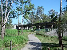
Logan has 924 parks and reserves all with combinations of facilities. Also Logan offers plenty of active choices such as local swimming pools, sporting clubs, cycling tracks, walking tracks, little athletics, tinnie trails (self guided heritage trail), golf, basketball/volleyball parks, skate parks, bmx tracks, walking groups and go karting.
Logan City has recently been under development for new bistro areas across the region. Cinemas, shopping complexes and parks are prevalent. The city also has a free public art gallery.[40] The internationally successful Australian band Savage Garden, who sold 25 million albums, are from Logan and so is Olympic swimmer Jodie Henry, three time gold medalist in the pool at the 2004 Olympics and world record holder.
Logan City Council is transforming the historic Kingston Butter Factory into a cultural landmark that facilitates entertainment and arts programs year-round. The outdoor stage is launching at the end of March 2022,[41] with the Butterbox Theatre and Living Arts Museum set to open mid-year 2022.
Logan City is home to Souths Logan Magpies rugby league team, one of the oldest existing rugby league clubs in Australia. It is also home to the Logan Thunder WNBL team.
Every Saturday at a free 5 km timed run takes place at four different locations in Logan City. The events are known as Logan River parkrun,[42] Yarrabilba parkrun, Riverdale parkrun,[43] and Berrinba parkrun.[44]
In 2021, the Proud City of Logan campaign was launched, a local government initiative featuring six local champions, chosen to represent the diversity of people and lifestyles in the city.[45]

Logan City Council operates public libraries in Beenleigh, Greenbank, Jimboomba, Logan Central, Logan Hyperdome (Shailer Park), Logan North (Underwood), Logan Village, Logan West (Browns Plains), and Marsden.[46]
A community arts centre is located at the former Kingston Butter Factory, now a locally listed heritage site.
Climate
[edit]Logan City has a humid subtropical climate (Köppen climate classification Cfa).
| Climate data for Beenleigh | |||||||||||||
|---|---|---|---|---|---|---|---|---|---|---|---|---|---|
| Month | Jan | Feb | Mar | Apr | May | Jun | Jul | Aug | Sep | Oct | Nov | Dec | Year |
| Mean daily maximum °C (°F) | 29.8 (85.6) |
29.4 (84.9) |
28.5 (83.3) |
26.4 (79.5) |
24.0 (75.2) |
21.6 (70.9) |
21.4 (70.5) |
22.6 (72.7) |
25.1 (77.2) |
26.5 (79.7) |
27.9 (82.2) |
29.0 (84.2) |
26.0 (78.8) |
| Mean daily minimum °C (°F) | 20.6 (69.1) |
20.5 (68.9) |
19.1 (66.4) |
16.0 (60.8) |
12.6 (54.7) |
10.1 (50.2) |
8.8 (47.8) |
9.5 (49.1) |
12.4 (54.3) |
14.9 (58.8) |
17.5 (63.5) |
19.2 (66.6) |
15.1 (59.2) |
| Average precipitation mm (inches) | 133.5 (5.26) |
150.8 (5.94) |
129.1 (5.08) |
81.1 (3.19) |
104.3 (4.11) |
75.5 (2.97) |
34.1 (1.34) |
47.4 (1.87) |
42.4 (1.67) |
62.9 (2.48) |
106.7 (4.20) |
140.1 (5.52) |
1,107.9 (43.63) |
| Source: https://weather.mla.com.au/climate-history/qld/beenleigh | |||||||||||||
Suburbs
[edit]
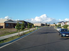
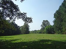
Over 80% of Logan is designated as non-urban, with the majority of land zoned rural, semi-rural or conservation.[47] Until 2008, Logan had a stable boundary with neighbouring local government areas such as Beaudesert, Albert (later merged into Gold Coast) and Brisbane. The following suburbs were included within the pre-2008 area:
|
|
In 2008, areas in northern Beaudesert as well as the Beenleigh conurbation in the Gold Coast were merged with Logan. As well as uniting Logan Reserve and Greenbank under one local government area, the following areas were added:
|
From Gold Coast: |
From Beaudesert: |
|
1 - split with the Scenic Rim Region
See also
[edit]References
[edit]- ^ a b c Australian Bureau of Statistics (28 June 2022). "Logan City (LGA)". 2021 Census QuickStats. Retrieved 28 February 2023.
- ^ a b "3218.0 – Regional Population Growth, Australia, 2017-18: Population Estimates by Local Government Area (ASGS 2018), 2017 to 2018". Australian Bureau of Statistics. Australian Bureau of Statistics. 27 March 2019. Archived from the original on 27 March 2019. Retrieved 25 October 2019. Estimated resident population, 30 June 2018.
- ^ "City of Logan". Logan Office of Economic Development. Retrieved 4 July 2024.
- ^ "Statistics and Facts". Logan City Council. Archived from the original on 1 February 2014. Retrieved 3 February 2014.
- ^ "Meadowbrook". Logan City Council. Archived from the original on 19 March 2016. Retrieved 30 December 2015.
- ^ "2016 Logan City Council - Mayoral Election - Election Summary". Electoral Commission of Queensland. 19 April 2016. Archived from the original on 30 May 2016. Retrieved 29 May 2016.
- ^ "Council accepts State Government legislation". Logan City Council. 22 May 2018. Archived from the original on 14 September 2018. Retrieved 31 October 2018.
- ^ "Logan City Council sacked by the Queensland Government". Australian Broadcasting Corporation. 4 April 2019. Archived from the original on 3 May 2019. Retrieved 6 May 2019.
- ^
 This Wikipedia article incorporates CC BY 4.0 licensed text from: "Yugembah". Queensland Aboriginal and Torres Strait Islander languages map. State Library of Queensland. Retrieved 28 January 2020.
- ^ a b Howells, Mary (2006). Ridge to Ridge: Recollections from Woodridge to Park Ridge. Logan City Council. p. 28. ISBN 0-9750519-2-X. Archived from the original on 2 November 2021. Retrieved 2 November 2021.
- ^ a b c d Buchanan, Robyn (1999). Logan : rich in history, young in spirit (PDF). Logan City Council. pp. 22–36. Archived (PDF) from the original on 8 February 2016. Retrieved 28 December 2015.
- ^ a b Starr, Joan (1988). Logan, the man, the river and the city. Tenterfield, New South Wales: Southern Cross PR and Press Services. p. 51. ISBN 0958802114. Archived from the original on 1 December 2021. Retrieved 3 December 2021.
- ^ Loftus, Tobi (21 January 2024). "The 1974 floods changed Brisbane forever, with thousands of homes destroyed and 16 lives lost". ABC News. Retrieved 21 January 2024.
- ^ a b c Howells, Mary (2003). Logan River Tinnie Trail. Logan City Council. p. 43. ISBN 0975051903.
- ^ Tony Keim. "Inquest into Slacks Creek house fire which killed 11 in 2011 to look at cause of deaths". The Courier Mail. News Ltd. Retrieved 6 July 2014.
- ^ Isobel Roe (27 September 2017). "Tesla Powerpack battery to power Logan reservoir". ABC News. Australian Broadcasting Corporation. Archived from the original on 17 October 2017. Retrieved 28 September 2017.
- ^ Queensland Local Government Reform Commission (July 2007). Report of the Local Government Reform Commission (PDF). Vol. 2. pp. 187–193. ISBN 978-1-921057-11-3. Archived (PDF) from the original on 17 March 2011. Retrieved 3 June 2010. See also map here Archived 7 April 2011 at the Wayback Machine.
- ^ "Logan Hospital Expansion Business Case/Cost Benefit Analysis Summary" (PDF). Government of Queensland. p. 4. Archived (PDF) from the original on 21 October 2021. Retrieved 21 October 2021.
- ^ a b Katherine Feeney (16 January 2013). "Logan by the numbers: unemployment, lower wages and more than 150 ethnic groups". The Brisbane Times. Fairfax Media. Archived from the original on 14 July 2014. Retrieved 6 July 2014.
- ^ Australian Bureau of Statistics (27 June 2017). "Logan City (LGA)". 2016 Census QuickStats. Retrieved 20 October 2018.
- ^ Economy ID (31 December 2016). "Logan Unemployment". Economy ID. Economy ID. Archived from the original on 5 March 2018. Retrieved 21 April 2017.
- ^ "Rankin - Federal Election 2007 - ABC (Australian Broadcasting Corporation)". www.abc.net.au. Archived from the original on 23 December 2012. Retrieved 5 March 2018.
- ^ Green, Antony (29 December 2007). "Australia Votes 2007 - Rankin". Australian Broadcasting Corporation. Archived from the original on 3 May 2008. Retrieved 15 April 2008.
- ^ "2016 Logan City Council - Councillor Election - Election Summary". Electoral Commission of Queensland. Queensland Government. Archived from the original on 5 August 2016. Retrieved 21 February 2018.
- ^ "Councillors". Logan City Council. Archived from the original on 6 June 2017. Retrieved 21 February 2018.
- ^ a b c d e f g h i j k l m "2020 Local Government Elections: Saturday, 28 March 2020". Electoral Commission of Queensland. 2020. Archived from the original on 16 June 2020. Retrieved 16 June 2020.
- ^ "Statistics and facts". Logan City Council. Archived from the original on 21 October 2021. Retrieved 22 October 2021.
- ^ "Logan Reserve SS". Archived from the original on 4 February 2017. Retrieved 1 February 2017.
- ^ "C & K Association". Archived from the original on 4 February 2017. Retrieved 1 February 2017.
- ^ a b c d e f g h i j k l m n o "Opening and closing dates of Queensland Schools". Queensland Government. Retrieved 18 April 2019.
- ^ "Waterford State School (Block A and Play Shed) (entry 602672)". Queensland Heritage Register. Queensland Heritage Council. Retrieved 21 October 2021.
- ^ "Logan Village SS". Archived from the original on 4 February 2017. Retrieved 1 February 2017.
- ^ "Loganholme SS". Archived from the original on 4 February 2017. Retrieved 1 February 2017.
- ^ "Logan City Special School". Archived from the original on 4 February 2017. Retrieved 1 February 2017.
- ^ "Berrinba East State School". Berrinba East State School. 9 May 2019. Archived from the original on 20 August 2019. Retrieved 20 August 2019.
- ^ "Loganlea SHS". Archived from the original on 4 February 2017. Retrieved 1 February 2017.
- ^ "Four new state schools to open their doors in 2018". Government of Queensland. 22 January 2018. Archived from the original on 22 January 2018. Retrieved 22 January 2018.
- ^ "Crestmead industrial estate". Queensland Government. Archived from the original on 27 May 2014. Retrieved 24 May 2014.
- ^ (28 August 2012) Tony Moore. Logan Queensland's pokies capital Archived 20 September 2013 at the Wayback Machine. Brisbane Times. Fairfax Media.
- ^ "About Logan Art gallery". Logan City Council. Archived from the original on 20 October 2021. Retrieved 20 October 2021.
- ^ "Our Logan: KBF Cultural Precinct Launch Party". Our Logan. 30 March 2022. Retrieved 31 March 2022.
- ^ "Logan River parkrun - Logan River parkrun". www.parkrun.com.au. Archived from the original on 2 July 2017. Retrieved 5 March 2018.
- ^ "Yarrabilba parkrun - Yarrabilba parkrun". www.parkrun.com.au. Archived from the original on 26 October 2017. Retrieved 5 March 2018.
- ^ "Berrinba parkrun - Berrinba parkrun". www.parkrun.com.au. Archived from the original on 27 September 2017. Retrieved 5 March 2018.
- ^ ""PROUD CITY CAMPAIGN LAUNCHES"". 2021. Archived from the original on 15 November 2021. Retrieved 4 December 2021.
- ^ Council, Logan City. "Library Locations". www.logan.qld.gov.au. Archived from the original on 6 June 2017. Retrieved 30 January 2018.
- ^ "Meadowbrook Master Plan" (PDF). Archived (PDF) from the original on 22 October 2021. Retrieved 23 October 2021.
