Llanelltyd
Appearance
| Llanelltyd | |
|---|---|
 Pont Wnin and the centre of the village | |
Location within Gwynedd | |
| Area | 43.09 km2 (16.64 sq mi) |
| Population | 514 (2011) |
| • Density | 12/km2 (31/sq mi) |
| OS grid reference | SH714194 |
| Community |
|
| Principal area | |
| Country | Wales |
| Sovereign state | United Kingdom |
| Post town | DOLGELLAU |
| Postcode district | LL40 |
| Dialling code | 01341 |
| Police | North Wales |
| Fire | North Wales |
| Ambulance | Welsh |
| UK Parliament | |
| Senedd Cymru – Welsh Parliament | |
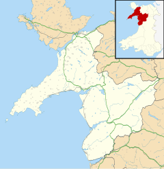
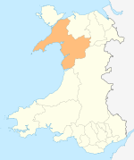
Llanelltyd is a small village and community in Gwynedd, to the northwest of Dolgellau. The community population taken at the 2011 Census was 514, 57.4% of which speak Welsh.[1]
It is home to the 12th-century Cymer Abbey, a grade I listed building.[2] St Illtyd's church, one of the oldest parish churches in Wales, is a grade II* listed building.[3]
The small settlement of Bontddu is in the community. The village itself has a population of around 300.[4]
Notable people born in Llanelltyd
[edit]- William Owen (1825–1894), Wisconsin State Assemblyman
References
[edit]- ^ "Community population 2011". Retrieved 14 May 2015.
- ^ "Cymer Abbey, a 470 (N Side), Cymer Abbey, Llanelltyd". British Listed Buildings. Retrieved 16 December 2013.
- ^ "Parish Church of St Illtyd including churchyard walls and gatepiers, Llanelltyd". British Listed Buildings. Retrieved 16 December 2013.
- ^ UK Census (2011). "Local Area Report – Llanelltyd population (W00000289)". Nomis. Office for National Statistics. Retrieved 9 July 2021.
External links
[edit]![]() Media related to Llanelltyd at Wikimedia Commons
Media related to Llanelltyd at Wikimedia Commons


