Landewednack
Appearance
Landewednack
| |
|---|---|
 St Wynwallow's church at Landewednack | |
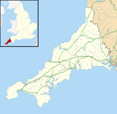
Location within Cornwall | |
| Population | 906 (United Kingdom Census 2011) |
| OS grid reference | SW706123 |
| Unitary authority | |
| Ceremonial county | |
| Region | |
| Country | England |
| Sovereign state | United Kingdom |
| Post town | HELSTON |
| Postcode district | TR12 |
| Dialling code | 01326 |
| Police | Devon and Cornwall |
| Fire | Cornwall |
| Ambulance | South Western |
| UK Parliament | |
Landewednack (Cornish: Lanndewynnek) is a civil parish and an area of The Lizard in Cornwall, England, United Kingdom. The hamlet is situated approximately ten miles (16 km) south of Helston.[1]
Landewednack is the most southerly parish on the British mainland.[2] The parish church, dedicated to St Winwallow, is the most southerly in England and is built of local serpentine stone (see St Wynwallow's Church, Landewednack). Caerthillian cove and beach sits on the western border of the parish.
The hamlet of Landewednack is now part of Lizard village.
Twinning
[edit]Landewednack is twinned with Landevennec (Landevenneg) in Brittany, France.[citation needed]
References
[edit]- ^ Ordnance Survey: Landranger map sheet 203 Land's End ISBN 978-0-319-23148-7
- ^ GENUKI website; Landewednack retrieved April 2010

External links
[edit]![]() Media related to Landewednack at Wikimedia Commons
Media related to Landewednack at Wikimedia Commons

