Lake Beeac
| Lake Beeac | |
|---|---|
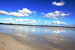
 Shallow water and the crystallizing of salt reflect the sky beautifully on Lake Beeac | |
Location in Victoria | |
| Location | Western District Lakes, Victoria |
| Coordinates | 38°12′18.5″S 143°36′59.5″E / 38.205139°S 143.616528°E[1] |
| Type | Endorheic, hypersaline |
| Primary outflows | Evaporation |
| Basin countries | Australia |
| Surface area | 560 ha (1,400 acres) |
| References | [1][2][3][4][5] |
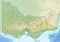
Lake Beeac, a hypersaline endorheic lake, is located beside the small town of Beeac in the Lakes and Craters region of the Victorian Volcanic Plains of south-west Victoria, in southeastern Australia. The 560-hectare (1,400-acre) lake is situated about 19 kilometres (12 mi) northeast of Colac, and its high salinity gives it a milky-blue colour. The lake is part of the Ramsar-listed Western District Lakes site, and enjoys international recognition of its wetland values and some protection for its waterbirds.[5]
Wildlife
[edit]Despite its extreme salinity, Lake Beeac supports brine shrimp which in turn feed water birds such as the banded stilt and the red-necked avocet.[5] Birds have been known to come from as far as Siberia and China to eat the lake's shrimp.[6] The lake is an important habitat for wetland water-birds. The lake forms part of the Lake Corangamite Complex Important Bird Area, so identified by BirdLife International because it sometimes supports globally important numbers of waterbirds.[7]
History
[edit]Between the late 1860s and the 1950s, salt works at Lake Beeac and other nearby lakes produced commercial quantities of salt.[5][8] The Melbourne spice merchant Henry Berry established a salt works at Lake Cundare, just north of Beeac, in 1868 which produced salt by a boiling and crystallising process. The works produced a fine salt for domestic consumption under the label "Tower of London". Production ceased in 1895.[9]
Lake Beeac was the main lake in the area used for the collecting of naturally crystallised salt during the summer months. This process produced a coarse salt that was sold for agricultural and industrial purposes. Production depended on the weather: during the hot dry summer of 1921, 3000 tonnes were produced, but in a wet summer no salt at all could be collected. Commercial production ceased in 1954, by which time cheaper production elsewhere had made the Lake Beeac salt uneconomical.[10]
See also
[edit]References
[edit]- ^ a b "Lake Beeac (VIC)". Gazetteer of Australia online. Geoscience Australia, Australian Government.
- ^ "An Audit of the Ecological Condition of Australian Rivers" (PDF). Environment Australia (PDF). Government of Australia.
- ^ "Lake Beeac (entry 7621)". VICNAMES. Government of Victoria.
- ^ "Map of Lake Beeac, VIC". Bonzle Digital Atlas of Australia. Retrieved 5 November 2014.
- ^ a b c d "Lake Beeac". Colac... a community website. Retrieved 1 December 2010.
- ^ "Beeac". Colac Otway Shire Council. Archived from the original on 16 February 2011. Retrieved 1 December 2010.
- ^ "Lake Corangamite Complex". Important Bird Areas factsheet. BirdLife International. 2011. Retrieved 19 July 2011.
- ^ Dawn Missen & Anne Trigg, Beeac: Winds of Change 1860–2010, Dawn Missen & Anne Trigg, Colac, 2011, pp. 74–75.
- ^ Norman Houghton, Scrapers and Boilers: Beeac's Lake Salt Trade 1868–1968, Norman Houghton, Geelong, 2016, pp. 2–16.
- ^ Houghton, pp. 22–25.

