Laguna del Carbón
Appearance
| Laguna del Carbón | |
|---|---|
 | |
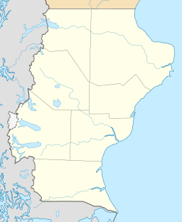
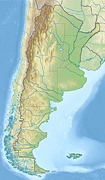
| Location | Corpen Aike Department, Santa Cruz Province, Argentina |
| Coordinates | 49°34′34″S 68°21′05″W / 49.5762°S 68.3514°W |
| Lake type | Endorheic salt lake |
| Primary outflows | Terminal (evaporation) |
| Basin countries | Argentina |
| Max. length | 5 km (3.1 mi) |
| Max. width | 2 km (1.2 mi) |
| Surface area | 9 km2 (3.5 sq mi) |
| Surface elevation | −105 m (−344 ft) |
 | |
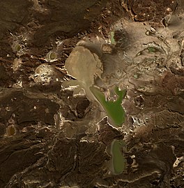
Laguna del Carbón (Spanish for "coal lagoon") is a salt lake in Corpen Aike Department, Santa Cruz Province, Argentina. This salt lake is located 54 kilometres (34 miles) from Puerto San Julián, within the Gran Bajo de San Julián (Great San Julián Depression), an endorheic basin situated between the San Julian Bay and the Chico River. At 105 metres (344 ft) below sea level, Laguna del Carbón is the lowest point of the Americas, and the seventh-lowest point on Earth.[1]
As in several other locations in Patagonia, dinosaur fossils have been found in the area.[2]
References
[edit]- ^ David K. Lynch. "Land Below Sea Level". Geology.com. Retrieved 2009-09-29.
- ^ Griffin, Miguel; Pastorino, Guido (Mar 2005). "The Genus Trophon Monfort, 1810 (Gastropoda: Muricidae) In The Tertiary Of Patagonia". Journal of Paleontology. 79 (2): 296–311. doi:10.1666/0022-3360(2005)079<0296:tgtmgm>2.0.co;2. Archived from the original on 18 May 2009. Retrieved 2 September 2010.
External links
[edit]- near Puerto san Julián: Laguna del Carbón
- Physiognomy of the Santa Cruz Province - Argentine Paleontologic Association
- Caroline and Stephen: 7 Lows South America - Laguna del Carbón images


