Líbeznice
Líbeznice | |
|---|---|
 Mělnická street | |
| Coordinates: 50°11′31″N 14°29′37″E / 50.19194°N 14.49361°E | |
| Country | |
| Region | Central Bohemian |
| District | Prague-East |
| First mentioned | 1236 |
| Area | |
• Total | 5.99 km2 (2.31 sq mi) |
| Elevation | 203 m (666 ft) |
| Population (2024-01-01)[1] | |
• Total | 3,211 |
| • Density | 540/km2 (1,400/sq mi) |
| Time zone | UTC+1 (CET) |
| • Summer (DST) | UTC+2 (CEST) |
| Postal code | 250 65 |
| Website | www |
Líbeznice is a municipality and village in Prague-East District in the Central Bohemian Region of the Czech Republic. It has about 3,200 inhabitants.
Etymology
[edit]The name is derived from the surname Líbezný, meaning "the village of Líbezný's people". The word líbezný, from which the surname arose, means 'lovely' in Czech.[2]
Geography
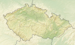
[edit]Líbeznice is located about 9 kilometres (6 mi) north of Prague. It lies in a flat agricultural landscape of the Central Elbe Table. The highest point is at 229 m (751 ft) above sea level.
History
[edit]The first written mention of Líbeznice is in a document from 1236 issued by King Wenceslaus I. In 1294, the village was divided between the Vyšehrad Chapter and Metropolitan Chapter at Saint Vitus in Prague, which lasted for more than 100 years. Among the next notable owners of Líbeznice was King George of Poděbrady and Old Town of Prague. From 1652 until the establishment of a sovereign municipality in 1848 (with a short break in the 1660s), the village was a property of the Nostitz family.[3]
Demographics
[edit]
|
|
| ||||||||||||||||||||||||||||||||||||||||||||||||||||||
| Source: Censuses[4][5] | ||||||||||||||||||||||||||||||||||||||||||||||||||||||||
Transport
[edit]The I/9 road (which connects the D8 motorway with Česká Lípa and the Czech-German border) passes through the municipality.
Education
[edit]In the municipality is a primary school.[6]
Sights
[edit]
The main landmark of Líbeznice is the Church of Saint Martin. It was built in the late Baroque style in 1788–1795.[7]
Notable people
[edit]- Ondřej Hutník (born 1983), kickboxer
References
[edit]- ^ "Population of Municipalities – 1 January 2024". Czech Statistical Office. 2024-05-17.
- ^ Profous, Antonín (1949). Místní jména v Čechách II: CH–L (in Czech). p. 586.
- ^ "Historie a památky" (in Czech). Obec Líbeznice. Retrieved 2023-12-28.
- ^ "Historický lexikon obcí České republiky 1869–2011" (in Czech). Czech Statistical Office. 2015-12-21.
- ^ "Population Census 2021: Population by sex". Public Database. Czech Statistical Office. 2021-03-27.
- ^ "Přehled škol a školských zařízení: Líbeznice". Rejstřík škol a školských zařízení (in Czech). Ministry of Education, Youth and Sports of the Czech Republic. Retrieved 2024-06-25.
- ^ "Kostel sv. Martina" (in Czech). National Heritage Institute. Retrieved 2023-12-28.
External links
[edit]


