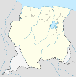
Kwamalasamutu
Kwamalasamutu
Kwamalasamoetoe | |
|---|---|
Village | |
| Coordinates: 2°21′23″N 56°47′12″W / 2.35639°N 56.78667°W | |
| Country | Suriname |
| District | Sipaliwini |
| Resort | Coeroeni |
| Government | |
| • Granman | Jimmy Toeroemang[1] |
| Population (2020) | |
• Total | 1,100[1] |
Kwamalasamutu, also Kwamalasamoetoe, is a Tiriyó Amerindian village in the Sipaliwini District of Suriname, and home to the granman (paramount chief) of the northern Trios. Kwamalasamutu is the biggest village of the Tiriyó tribe[2] and is located near the disputed border with Guyana.
History
[edit]The village was built in 1971, because Alalapadu was getting too small. The population is estimated at 1,100 as of 2020.[3] Kwamalasamutu has a school, clinic, and a Baptist church, and since 2010 it has access to the telephone network. The economy is based on small-scale agriculture.[2] The village is also home to small groups of the Wai Wai tribe.[2] The last two speakers of the Mawayana language are in Kwamalasamutu as of 2015.[4][5]
Tourism
[edit]The Werehpai archaeological site, which consists of caves containing petroglyphs of pre-Columbian origin, is located about 10 kilometres from Kwamalasamutu.[6]
Healthcare
[edit]Kwamalasamutu is home to a Medische Zending healthcare centre.[7]
Energy
[edit]Like most villages in the Surinamese interior, Kwamalasamutu relies on diesel generators for electricity. The government provides diesel oil for free to produce electricity for about 5–6 hours per day. In 1994 solar panels were installed with the intention to provide electricity for the entire day, but an evaluation study conducted in 2013 showed that lack of maintenance has meant that none of the systems installed in 1994 still worked in 2013. Instead people have used the panels from 1994 that still worked for their own systems, with some having invested in additional panels themselves. New projects are underway to provide electricity in the interior in a hybrid way, with diesel generators taking over production during night.[8]
Transportation
[edit]Kwamalasamutu can be reached by boat on the Sipaliwini River[9] or by plane using the Kwamelasemoetoe Airstrip which offers scheduled services to and from Paramaribo.[10]
Notes
[edit]- ^ a b "Dorpen en Dorpsbesturen". Vereniging van Inheemse Dorpshoofden in Suriname (in Dutch). Retrieved 22 June 2022.
- ^ a b c "DORPSPLAN KWAMALASAMUTU 2011–2014" (PDF). Institute for Graduate Studies and Research (IGSR) (in Dutch). Archived from the original (PDF) on 15 June 2020. Retrieved 27 May 2020.
- ^ "Dorpen en Dorpsbesturen". Vereniging van Inheemse Dorpshoofden in Suriname (in Dutch). Retrieved 4 February 2020.
- ^ Carlin 2006, p. 317.
- ^ Mans & Carlin 2015, p. 98.
- ^ "A Survey of the Large Mammal Fauna of the Kwamalasamutu Region, Suriname". Bioone.org (in Dutch). Retrieved 27 May 2020.
- ^ "Zorggebied". Medische Zending.sr (in Dutch). Archived from the original on 30 September 2022. Retrieved 27 May 2020.
- ^ "Minister Jim Hok (NH) wil zonne-energie voor inheems dorp Kwamalasamutu". Obsession magazine. 23 July 2013. Retrieved 25 April 2016.
- ^ "Waterleiding bedrijf Suriname pakt drinkwater probleem Kwamalasamutu aan". Waterkant (in Dutch). Retrieved 17 June 2020.
- ^ "SMSM - Airport". GC Map. Retrieved 17 June 2020.
References
[edit]- Carlin, Eithne B. (2006). Feeling the Need (PDF). University of Leiden.
- Heemskerk, Marieke; Delvoye, Katia (2007). Trio Baseline Study: A sustainable livelihoods perspective on the Trio Indigenous Peoples of South Suriname (PDF). Paramaribo: Stichting Amazon Conservation Team-Suriname.
- Mans, Jimmy; Carlin, Eithne B. (2015). Movement through Time in the Southern Guianas: Deconstructing the Amerindian Kaleidoscope. Leiden: Brill.

