Krugloozyornoye
Appearance
Krugloozyornoye
Круглоозёрное | |
|---|---|
Urban-type settlement | |
 Krugloozyornoye, with the Kushum branching off the Ural Sentinel-2 image | |
| Coordinates: 51°04′57″N 51°17′07″E / 51.08250°N 51.28528°E | |
| Country | Kazakhstan |
| Regione | West Kazakhstan Region |
| District | Oral City Administration |
| Established | 1930 |
| Population (2022) | |
| • Total | 6,016 |
| Time zone | UTC+5 (UTC + 5) |
Krugloozyornoye (Kazakh: Круглоозёрное) is an urban-type settlement in the Oral City Administration, West Kazakhstan Region, Kazakhstan. Since 2013 it includes the nearby village of Serebryakovo[1] (KATO code - 271039100). Population: 3,782 (2009 Census results);[2] 2,942 (1999 Census results).[2]
Geography
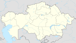
[edit]Krugloozyornoye is located by the west bank of the Ural river, south of where the Kushum branches off the Ural. It lies 11 kilometers (6.8 mi) SSW of Oral City.[3][4]
References
[edit]- ^ "О внесении изменений в административно-территориальные устройства города Уральск Западно-Казахстанской области". tengrinews.kz. Archived from the original on 2016-10-12. Retrieved 2016-10-11.
- ^ a b "Население Республики Казахстан" [Population of the Republic of Kazakhstan] (in Russian). Департамент социальной и демографической статистики. Retrieved 8 December 2013.
- ^ "M-39 Topographic Chart (in Russian)". Retrieved 28 February 2023.
- ^ Google Earth.


