Klenčí pod Čerchovem
Klenčí pod Čerchovem | |
|---|---|
 Church of Saint Martin | |
| Coordinates: 49°25′55″N 12°48′53″E / 49.43194°N 12.81472°E | |
| Country | |
| Region | Plzeň |
| District | Domažlice |
| Founded | 1325 |
| Area | |
• Total | 18.09 km2 (6.98 sq mi) |
| Elevation | 497 m (1,631 ft) |
| Population (2024-01-01)[1] | |
• Total | 1,459 |
| • Density | 81/km2 (210/sq mi) |
| Time zone | UTC+1 (CET) |
| • Summer (DST) | UTC+2 (CEST) |
| Postal codes | 344 01, 345 33, 345 34 |
| Website | www |
Klenčí pod Čerchovem (until 1946 Kleneč pod Čerchovem; German: Klentsch) is a market town in Domažlice District in the Plzeň Region of the Czech Republic. It has about 1,500 inhabitants. The historic centre is well preserved and is protected by law as a village monument zone.
Administrative parts
[edit]The villages of Capartice, Černá Řeka and Jindřichova Hora are administrative parts of Klenčí pod Čerchovem.
Geography
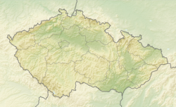
[edit]Klenčí pod Čerchovem is located about 8 kilometres (5 mi) west of Domažlice and 51 km (32 mi) southwest of Plzeň. It lies mostly in the Upper Palatine Forest. The highest point is the Bučina hill at 860 m (2,820 ft) above sea level. The mountain of Čerchov, involved in the market town's name, is located south of the market town outside the municipal territory. A notable body of water is the Klenečský pond, located in the northeastern part of Klenčí pod Čerchovem.
History
[edit]Klenčí was founded in 1325 by Chods. In the second half of the 17th century, the settlement grew and became a market town.[2]
Demographics
[edit]
|
|
| ||||||||||||||||||||||||||||||||||||||||||||||||||||||
| Source: Censuses[3][4] | ||||||||||||||||||||||||||||||||||||||||||||||||||||||||
Transport
[edit]Klenčí pod Čerchovem is located on the railway line Domažlice–Planá.[5]
Sights
[edit]The centre of Klenčí pod Čerchovem is known for preserved examples of folk architecture. The main landmark is the Church of Saint Martin, built in the Baroque style in 1737–1745.[2]
Notable people
[edit]- Jindřich Šimon Baar (1869–1925), Catholic priest and writer
Twin towns – sister cities
[edit]Klenčí pod Čerchovem is twinned with:[6]
 Herent, Belgium
 Kleneč, Czech Republic
 Waldmünchen, Germany
References
[edit]- ^ "Population of Municipalities – 1 January 2024". Czech Statistical Office. 2024-05-17.
- ^ a b "Městys" (in Czech). Městys Klenčí pod Čerchovem. Retrieved 2023-10-31.
- ^ "Historický lexikon obcí České republiky 1869–2011" (in Czech). Czech Statistical Office. 2015-12-21.
- ^ "Population Census 2021: Population by sex". Public Database. Czech Statistical Office. 2021-03-27.
- ^ "Detail stanice Klenčí p.Čerchovem" (in Czech). České dráhy. Retrieved 2023-10-31.
- ^ "Partnerská města" (in Czech). Městys Klenčí pod Čerchovem. Retrieved 2023-06-28.


