Khlong Phraya Wildlife Sanctuary
Appearance
| Khlong Phraya Wildlife Sanctuary | |
|---|---|
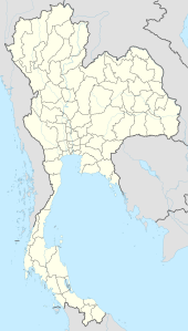
Location in Thailand | |
| Location | Thailand |
| Nearest city | Surat Thani |
| Coordinates | 8°25′N 98°58′E / 8.417°N 98.967°E |
| Area | 153.6 km² |
| Established | 1980 |
| Governing body | Wildlife Conservation Office |
Khlong Phraya (Thai: คลองพระยา) is a wildlife sanctuary in southern Thailand, at the boundary of Surat Thani and Krabi Provinces.
It covers an area of 153.6 km² (95,988 rai) of the districts Plai Phraya, Phrasaeng, and Chai Buri. The terrain is mostly mountainous and covered with dense forests, but also some grassland.
Animals in the area are langurs, muntjac, tapirs and hornbills.
The wildlife preserve was established on 31 October 1980, originally covering 95 km² (59,375 rai) of Krabi Province.[2] On 7 May 1993 it was enlarged by 58.6 km² (36,613 rai) to include parts of Surat Thani Province as well.[3]
References
[edit]- ^ UNEP-WCMC (2025). Protected Area Profile for Khlong Phraya from the World Database on Protected Areas, January 2025.
- ^ พระราชกฤษฎีกากำหนดบริเวณที่ดินป่าคลองพระยา ในท้องที่ตำบลปลายพระยา อำเภอปลายพระยา ตำบลคลองหิน อำเภอ่าวลึก และตำบลเขาดิน อำเภอเขาพนม จังหวัดกระบี่ ให้เป็นเขตรักษาพันธุ์สัตว์ป่า พ.ศ. ๒๕๒๓ (PDF). Royal Gazette (in Thai). 97 (174 ก special): 8–11. November 12, 1980. Archived from the original (PDF) on May 10, 2012.
- ^ พระราชกฤษฎีกากำหนดบริเวณที่ดินป่าคลองพระยา ในท้องที่ตำบลบางสวรรค์ อำเภอพระแสง ตำบลคลองน้อย ตำบลไทรทอง กิ่งอำเภอชัยบุรี อำเภอพระแสง จังหวัดสุราษฎร์ธานี และตำบลปลายพระยา ตำบลคีรีวง อำเภอปลายพระยา ตำบลหน้าเขา อำเภอเขาพนม ตำบลคลองยา อำเภออ่าวลึก จังหวัดกระบี่ ให้เป็นเขตรักษาพันธุ์สัตว์ป่า พ.ศ. ๒๕๓๖ (PDF). Royal Gazette (in Thai). 110 (60 ก special): 22–24. May 7, 1993. Archived from the original (PDF) on May 10, 2012.
External links
[edit]- Forestry department (Thai only)
- ASEAN Center of Biodiversity

