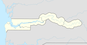
Kaur, The Gambia
This article needs additional citations for verification. (January 2025) |
Kaur | |
|---|---|
| Coordinates: 13°42′N 15°20′W / 13.700°N 15.333°W | |
| Country | The Gambia |
| Division | Central River Division |
| District | Lower Saloum |
| Population | |
| • Ethnicities | Mandinka Wolof |
| Time zone | UTC+0 (GMT) |
Kaur, also spelled Kauur or Kawur, is a town in the Lower Saloum district of the Central River Division of The Gambia.
Toponymy
[edit]According to local legend, the village was named by Maad Saloum Mbegane Ndour when he told his followers to take their cattle to the river to drink, saying in Fula “Ngareen Kawreen Dandeh Mayo”, meaning let us meet near the river, hence the name Kaur (from the word Kawreen).[1]
History
[edit]According to local tradition, Kaur was founded over 800 years ago by the brothers Baba and Karim Diané, Jakhanke traders. Early inhabitants may have included the Bainuk people.[2] Located near the uppermost edge of the mangrove ecosystem,[3][failed verification] Kaur was historically one of the most important trade towns on the Gambia river. A part of the Kingdom of Saloum since at least the mid-15th century, it was described by Andre Donelha and Francis Moore in their writings.[4] Kaur was located in the province of Kajmoor.[5]
People
[edit]13°42′N 15°20′W / 13.700°N 15.333°W
References
[edit]- ^ Al hajie A. E. Cam Joof, “chossani Senegambia », in, Weekend Observer, July 19-20, 1996, p. 11, cited in Fall, 2022 p. 395
- ^ Fall 2022, p. 132, 420.
- ^ Emms, Craig; Barnett, Linda & Human, Richard (2006). The Gambia. Bradt Travel Guides. p. 25-8. ISBN 978-1-84162-137-1.
- ^ Fall 2022, p. 94.
- ^ Fall 2022, p. 132.
Sources
[edit]- Fall, Rokhaya (2022). Un espace de rencontre en Sénégambie : le Saalum (XVIe – XIXe siècle). Harmattan.

