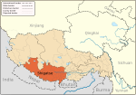
Kangru Chhu

Kangru Chhu (Chinese: 康如普曲, Tibetan: ཁང་རུ་ཆུ་, lit. “Glacial Valley River”) is a high-altitude river in Kangmar County, Tibet Autonomous Region, China. Originating from the Zurkar Glacier (5,820 m elevation) on the northern slopes of the Himalayas, it flows 148 km southeast before merging with the Rongshar Tsangpo, a tributary of the Yarlung Tsangpo (Brahmaputra) basin.[1]
Geography
[edit]The river's watershed spans 2,300 km², primarily draining alpine meadows and arid valleys. Its average discharge is 18 m³/s (peaking at 120 m³/s during July glacial melts). Notable features include Tramo Hot Springs near its upper course and the Drakar Gorge, a 12 km canyon with 300 m vertical cliffs.[2] Economically, it supports 16 irrigation channels watering 6,500 hectares of barley and pea fields in Kangmar. A 15 MW hydropower station, operational since 2018, supplies 40% of the county's electricity. Ecologically, it sustains populations of snow trout (Schizopygopsis stoliczkai) and serves as a corridor for migratory blue sheep.[3][4]
Culturally, the river is revered as a nechhu (sacred water) by local Buddhists. Annual Kangru Chhu Offering Rituals occur each May, where devotees float barley flour sculptures to honor mountain deities. A 14th-century cliffside carving of Padmasambhava overlooks its middle reaches.[5]
References
[edit]- ^ China. 民政部; China. 建设部 (1993). 中国县情大全: 西南卷:. 中国县情大全 (in Chinese). 中国社会出版社. p. 1540. ISBN 978-7-80088-206-7. Retrieved 2025-02-08.
- ^ 西藏研究 (in Chinese). 《西藏研究》 编辑部. 2007. p. 69. Retrieved 2025-02-08.
- ^ 西藏地貎. 青藏高原科学考察丛书 (in Chinese). 科学出版社. 1983. p. 55. Retrieved 2025-02-08.
- ^ 国家测絵局地名研究所 (1996). བོད་ལྗོངས་ས་མིང་།, tibétain (in Dzongkha). 中国藏学出版社. p. 238. ISBN 978-7-80057-284-5. Retrieved 2025-02-08.
- ^ 11世纪西藏的佛教艺术: 从扎塘寺壁画研究出发. 现代中国藏学文库 (in Chinese). 中国藏学出版社. 2008. p. 183. ISBN 978-7-80253-019-5. Retrieved 2025-02-08.

