Jraifia
Appearance
Jraifia
اجريفية | |
|---|---|
Rural Commune and Town | |
| Coordinates: 25°15′45″N 14°14′2″W / 25.26250°N 14.23389°W | |
| Territory | Western Sahara |
| Region | Laâyoune-Sakia El Hamra |
| Province | Boujdour Province |
| Area | |
• Total | 818.89 km2 (316.18 sq mi) |
| Population (2014) | |
• Total | 950 |
| • Density | 1.2/km2 (3.0/sq mi) |
| Year | Pop. | ±% |
|---|---|---|
| 2004 | 1,385 | — |
| 2014 | 950 | −31.4% |
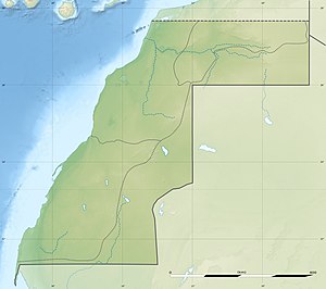
Jraifia is a small town and rural commune in the Boujdour Province of the Laâyoune-Sakia El Hamra region of the Moroccan-controlled part of Western Sahara. At the time of the 2014 census, the commune had a total population of 950 people.[1] The commune contains the Ramsar site Côte Aftissate-Boujdour.
References
[edit]- ^ Haut-Commissariat au plan (ed.). "Population légale des régions, provinces, préfectures, municipalités, arrondissements et communes du Royaume d'après les résultats du RGPH 2014" (xlsx). Retrieved 21 February 2019.


