Ismailli State Reserve
| Ismailli State Reserve | |
|---|---|
 The Ismailli State Reserve | |
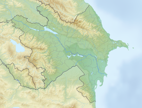
Map of Azerbaijan | |
| Location | Ismayilli District and Qabala District, Azerbaijan |
| Nearest city | Qabala |
| Area | 57.78 km2 (22.31 sq mi) |
| Established | 1981 |
Ismailli State Reserve or Ismayilly State Reserve was established in Azerbaijan on an area of 57.78 square kilometres (22.31 sq mi) in 1981 for the preservation and protection of natural complexes, occupying the north part of the southern slope of Major Caucasus.
The area of the reserve was expanded by 109.60 square kilometres (42.32 sq mi) and brought to 167 square kilometres (64 sq mi) in June 2003.
The forests are mainly formed of beeches, hornbeams and oaks, with small numbers of birch trees, cud, lime-trees, etc. Among them are chestnut-leaved oak and horehound oak that are included in the Red Book of Azerbaijan. The reserve accounts for nearly 170 animal species. 104 bird species of 13 orders are found in the reserve. Such mammals as a Brown bear, wild cat, lynx, Caucasian dear, Roe deer, Chamois and Caucasian goat populate the reserve.
See also
[edit]- Nature of Azerbaijan
- National Parks of Azerbaijan
- State Reserves of Azerbaijan
- State Game Reserves of Azerbaijan
References
[edit]40°58′00″N 48°06′07″E / 40.96667°N 48.10194°E

