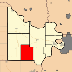
Independence Township, Doniphan County, Kansas
Appearance
Independence Township, Doniphan County, Kansas | |
|---|---|
 Location in Doniphan County | |
| Coordinates: 39°41′55″N 095°10′01″W / 39.69861°N 95.16694°W | |
| Country | United States |
| State | Kansas |
| County | Doniphan |
| Area | |
• Total | 36.99 sq mi (95.8 km2) |
| • Land | 36.98 sq mi (95.79 km2) |
| • Water | 0.01 sq mi (0.01 km2) 0.01% |
| Elevation | 1,020 ft (311 m) |
| Population (2020) | |
• Total | 257 |
| • Density | 6.9/sq mi (2.7/km2) |
| GNIS feature ID | 473013 |
Independence Township is a township in Doniphan County, Kansas, United States. As of the 2020 census, its population was 257.
Geography
[edit]Independence Township covers an area of 36.99 square miles (95.8 km2) and contains no incorporated settlements.
The streams of Jordan Creek and North Branch Independence Creek run through this township.
Demographics
[edit]As of the 2020 census, there were 257 people living in the township. The population density was 6.9 inhabitants per square mile (2.7/km2). There were 129 housing units. The racial makeup of the township was 95.3% White alone, 0.4% Some Other Race alone, and 4.3% two or more races.
See also
[edit]References
[edit]External links
[edit]

