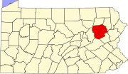
Hunlock Creek, Pennsylvania
Appearance
Hunlock Creek, Pennsylvania | |
|---|---|
| Coordinates: 41°12′21″N 76°03′58″W / 41.20583°N 76.06611°W | |
| Country | United States |
| State | Pennsylvania |
| County | Luzerne |
| Township | Hunlock |
| Elevation | 528 ft (161 m) |
| Time zone | UTC-5 (Eastern (EST)) |
| • Summer (DST) | UTC-4 (EDT) |
| ZIP code | 18621 |
| Area code(s) | 272 & 570 |
| GNIS feature ID | 1203858[1] |
Hunlock Creek is an unincorporated community in Hunlock Township, Luzerne County, Pennsylvania, United States.[1] The community is located along the Susquehanna River and U.S. Route 11, 3.2 miles (5.1 km) west of Nanticoke. Hunlock Creek has a post office with ZIP code 18621.[2][3] In 1940, a regional guidebook noted that the town, "its shacks resting in a mountain cleft, is named for the coal-blackened stream that splits it into a number of sections. US 11 parallels the winding river through a long valley that broadens out occasionally to include a cultivated tract on the river flat."[4]
References
[edit]- ^ a b "Hunlock Creek". Geographic Names Information System. United States Geological Survey, United States Department of the Interior.
- ^ United States Postal Service. "USPS - Look Up a ZIP Code". Retrieved August 15, 2017.
- ^ "Postmaster Finder - Post Offices by ZIP Code". United States Postal Service. Archived from the original on April 28, 2019. Retrieved August 15, 2017.
- ^ Federal Writers' Project (1940). Pennsylvania: A Guide to the Keystone State (1st ed.). New York: Oxford University Press. p. 478.


