Howlan, Prince Edward Island
Appearance
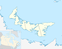
Location of Howlan in Prince Edward Island
Howlan is a small, unincorporated community of Prince County in the western part of Prince Edward Island in Canada.[1] Route 148 passes through Howlan[2] as Gaspe Road.[3] The Confederation Trail runs through the community.
Name
[edit]The town was named after George William Howlan.[4]
Location
[edit]Howlan is near the communities of O'Leary and Bloomfield,[3] in western Prince Edward Island. Its exact location is North 46°44', West 64°13'.[5]
Services
[edit]Howlan is very small and does not have any stores or public buildings, other than a church on Howlan Road and the Mill River Resort just outside the community.[6]
References
[edit]- ^ "Howlan, Prince Edward Island". The Government of Prince Edward Island. Retrieved 31 December 2024.
- ^ "Man dies as snowmobile and truck collide in West Prince". CBC. 23 February 2021. Retrieved 31 December 2024.
- ^ a b "Island Information Map". maps.gov.pe.ca. Retrieved 26 January 2025.
- ^ "History and Folklore of West Prince - Communities". epe.lac-bac.gc.ca. Retrieved 29 January 2025.
- ^ "PlaceFinder:". www.gov.pe.ca. Retrieved 29 January 2025.
- ^ "Mill River Resort, 180 Mill River Resort Rd. Route 136, Lot 5, PE C0B 1V0, CA - MapQuest". www.mapquest.com. Retrieved 29 January 2025.
46°43′44″N 64°13′23″W / 46.729°N 64.223°W

