Guaxindiba River
Appearance
| Guaxindiba River | |
|---|---|
| Native name | Rio Guaxindiba (Portuguese) |
| Location | |
| Country | Brazil |
| Physical characteristics | |
| Source | |
| • location | Rio de Janeiro state |
| Mouth | |
• location | Guanabara Bay |
• coordinates | 22°44′36″S 43°01′35″W / 22.7432°S 43.0265°W |
• elevation | 0 m (0 ft) |
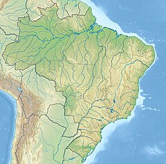
The Guaxindiba River (Portuguese: Rio Guaxindiba) is a river of Rio de Janeiro state in southeastern Brazil.
The Guaxindiba River flows through a flat region of mangroves in the 1,936 hectares (4,780 acres) Guanabara Ecological Station before discharging into the east of Guanabara Bay near the city of Rio de Janeiro.[1]
See also
[edit]References
[edit]- ^ Unidade de Conservação: Estação Ecológica da Guanabara (in Portuguese), MMA: Ministério do Meio Ambiente, retrieved 2016-10-05

