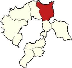
Gmina Wilamowice
Gmina Wilamowice
Wilamowice Commune | |
|---|---|
 Gmina Wilamowice within the Bielsko County | |
| Coordinates (Wilamowice): 49°54′59″N 19°9′7″E / 49.91639°N 19.15194°E | |
| Country | |
| Voivodeship | Silesian |
| County | Bielsko |
| Seat | Wilamowice |
| Area | |
• Total | 56.72 km2 (21.90 sq mi) |
| Population (2019-06-30[1]) | |
• Total | 17,613 |
| • Density | 310/km2 (800/sq mi) |
| • Urban | 3,100 |
| • Rural | 14,513 |
| Website | http://www.gmina.wilamowice.pl |
Gmina Wilamowice is an urban-rural gmina (administrative district) in Bielsko County, Silesian Voivodeship, in southern Poland. Its seat is the town of Wilamowice, which lies approximately 12 kilometres (7 mi) north-east of Bielsko-Biała and 39 km (24 mi) south of the regional capital Katowice. It is known for the Wymysorys language, which is spoken by some of the people here, mainly among the Vilamovian ethnic minority in Wilamowice.
The gmina covers an area of 56.72 square kilometres (21.9 sq mi), and as of 2019 its total population is 17,613.
Villages
[edit]Apart from the town of Wilamowice, Gmina Wilamowice contains the villages and settlements of Dankowice, Hecznarowice, Pisarzowice, Stara Wieś and Zasole Bielańskie.
Neighbouring gminas
[edit]Gmina Wilamowice is bordered by the city of Bielsko-Biała and by the gminas of Bestwina, Brzeszcze, Kęty, Kozy and Miedźna.
Twin towns – sister cities
[edit]Gmina Wilamowice is twinned with:[2]
 Dolní Benešov, Czech Republic
 Horná Súča, Slovakia
 Kisújszállás, Hungary
 Klanjec, Croatia
 Kloštar Ivanić, Croatia
 Kunerad, Slovakia
 Rajecké Teplice, Slovakia
 Trenčianske Teplice, Slovakia
 Županja, Croatia
References
[edit]- ^ "Population. Size and structure and vital statistics in Poland by territorial division in 2019. As of 30th June". stat.gov.pl. Statistics Poland. 2019-10-15. Retrieved 2020-02-14.
- ^ "Miejscowości partnerskie". gmina.wilamowice.pl (in Polish). Gmina Wilamowice. Archived from the original on 2023-01-09. Retrieved 2020-03-11.


