Gigerwaldsee
Appearance
| Gigerwaldsee | |
|---|---|
 | |
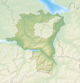
 map | |
| Location | Canton of St. Gallen |
| Coordinates | 46°54′51″N 9°22′24″E / 46.91417°N 9.37333°E |
| Type | reservoir |
| Catchment area | 52.06 km2 (20.10 sq mi) |
| Basin countries | Switzerland |
| Surface area | 0.71 km2 (0.27 sq mi) |
| Max. depth | 135 m (443 ft) |
| Water volume | 35.6 million cubic metres (28,900 acre⋅ft) |
| Surface elevation | 1,335 m (4,380 ft) |
 | |
Gigerwaldsee is a reservoir in the municipality of Pfäfers, in the Canton of St. Gallen, Switzerland. The reservoir has a volume of 35.6 million m³ and covers a surface area of 71 ha (180 acres).
The arch dam Gigerwald, which was completed in 1976, stands at a height of 147 m.

See also
[edit]External links
[edit] Media related to Gigerwaldsee at Wikimedia Commons


