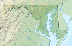
Gay Street, Baltimore
Appearance
Gay Street | |
|---|---|
 Rowhouses on the 1000 block of N. Caroline Street in Gay Street, Baltimore | |
| Coordinates: 39°18′05″N 76°35′51″W / 39.30139°N 76.59750°W | |
| Country | |
| State | |
| City | |
| Time zone | UTC−5 (Eastern) |
| • Summer (DST) | UTC−4 (EDT) |
| Area Codes | 410, 443, 667 |
Gay Street is a neighborhood in southeast Baltimore, Maryland.[1]
References
[edit]- ^ Baltimore's Neighborhood Statistical Areas (PDF) (Map). City of Baltimore Department of Planning. December 20, 2016. Retrieved November 30, 2021.


