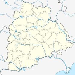
Gandeed
Appearance
This article needs additional citations for verification. (February 2020) |
Gandeed | |
|---|---|
Mandal | |
| Coordinates: 16°55′25″N 77°48′19″E / 16.92361°N 77.80528°E | |
| Country | |
| State | Telangana |
| District | Mahabubnagar |
| Talukas | Parigi |
| Population (2007) | |
• Total | 61,683 |
| Languages | |
| • Official | Telugu |
| Time zone | UTC+5:30 (IST) |
| PIN | 509337 |
| Vehicle registration | TS |
| Website | telangana |
| mandal president in gandeed = K. Madhavi rajkumar Reddy | |
Gandeed is a Mandal in Mahabubnagar district in the state of Telangana in India.[1]
It further have many villages mainly Nancherla, Gadrial, Rusumpally, Mohammadabad (which is supposed to be declared as an independent new mandal very soon)
Geography
[edit]The name of the village was originally Gandi veedu. But, in the long run, it changed to Gandeed.
This area is very much required its development by the Govt. of A.P in terms of every aspect, because it exists border to Karnataka and ignored by the leaders & the Govt., Because of the people's innocence as they never raises their voice on developmental activities against Govt./Leaders. - S.Baswaraj, Gandeed
The following is the list of village panchayats in Gandeed mandal.
- Rususmpally
- Jangum-
- Reddypally
- Gandeed
- Komreddypally
- Mansurpally
- Pagidyal
- Varahagiripally
- Salkarpet
- Baispally
- Balsurgonda
- Gadiryal
- Lingaipally
- Nancharla
- Mangampet
- Mokarlabad
- Chowderpally
- Mohammadabad
- Annareddypally
- Julapally
- Sangaipally
- Kaplapur
- Vennached
- Pedda warwal
- Chinna warwal
- Salarnagar
- Chelmilla
- Jinnaram
- Venkatreddypally
- Kanchanpally
References
[edit]- ^ "List of Sub-Districts". Census of India. Retrieved 14 May 2007.


