Fritz Cove
| Fritz Cove | |
|---|---|
| Location | Stephens Passage, Juneau, Alaska |
| Coordinates | 58°19′41″N 134°38′30″W / 58.32806°N 134.64167°W |
| River sources | Cove Creek, Elevenmile Creek, Fish Creek |
| Basin countries | United States |
| Max. depth | 30 fathoms (55 m) |
| Islands | Spuhn Island |
Fritz Cove is a bay on the northwestern coast of Douglas Island in the City and Borough of Juneau, Alaska, United States.[1] Lying in Stephens Passage, it is 8 miles (13 km) northwest of the city of Juneau.
History
[edit]Historically, Fritz Cove was used for fishing by Alaska Natives, especially the Auke people. A summer camp named Aangoox̱a Yé was located at the mouth of Fish Creek.[2] Scottish-American naturalist John Muir camped at the bay on November 10, 1879.[3]
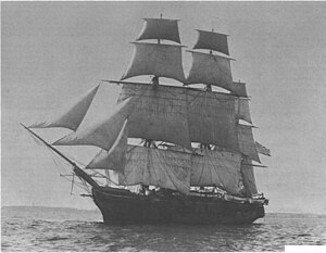
The area was surveyed by the USS Jamestown in 1880;[4][5] Lieutenant F. M. Symonds named the bay after his son. The name was first published by the United States Coast and Geodetic Survey in 1881.[6]
Geography
[edit]Fritz Cove and Gastineau Channel became linked in 1960 through a United States Army Corps of Engineers effort to dredge a navigation route.[7]
Streams flowing into Fritz Cove include Cove Creek,[8] Elevenmile Creek,[9] and Fish Creek.[10] Islands in the bay include Spuhn Island.[11] Depths in the bay range from 8 to 30 fathoms (15 to 55 m).[12]

Dungeness crabs,[13] Tanner crabs,[14] and king salmon[15] live in the cove; molting of the male Tanner crabs in the cove has been documented since the 1970s.[16] Scoters, grebes, mergansers, and marbled murrelets can also be seen in the area.[17]
References
[edit]- ^ U.S. Coast and Geodetic Survey. United States Coast Pilot: Alaska, Part I: Dixon Entrance to Yakutat Bay, Sixth Edition, p. 158. Government Printing Office: Washington, 1917.
- ^ Goldschmidt, Walter R., and Haas, Theodore H. Haa Aaní, Our Land: Tlingit and Haida Land Rights and Use. Sealaska Corporation, 1998.
- ^ Muir, John; Engberg, Robert (ed.); and Merrell, Bruce (ed.) Letters from Alaska. University of Wisconsin Press: Madison, Wisconsin, 1993.
- ^ Annual Report of the Hydrographic Office for the Fiscal Year 1924. Government Printing Office: Washington, 1924.
- ^ U.S.S. Jamestown Warship and Her Personnel, 1880 and 1881. Alaska Trails to the Past. Accessed June 23, 2010.
- ^ USGS GNIS Feature Detail Report: Fritz Cove. Accessed July 23, 2010.
- ^ Pursell, Jenny (July 11, 2004). "Trek through 'the flats' reveals beauty of wetlands". Juneau Empire. Retrieved December 11, 2010.
- ^ USGS GNIS Feature Detail Report: Cove Creek. Accessed July 23, 2010.
- ^ USGS GNIS Feature Detail Report: Elevenmile Creek. Accessed July 23, 2010.
- ^ USGS GNIS Feature Detail Report: Fish Creek. Accessed July 23, 2010.
- ^ USGS GNIS Feature Detail Report: Spuhn Island. Accessed July 23, 2010.
- ^ U.S. Coast and Geodetic Survey. Table of Depths for Channels and Harbors, p. 117. Government Printing Office: Washington, 1913.
- ^ Stone, Robert P., and O'Clair, Charles E. "Behavior of Female Dungeness Crabs, Cancer magister, in a Glacial Southeast Alaska Estuary: Homing, Brooding-Site Fidelity, Seasonal Movements, and Habitat Use". Journal of Crustacean Biology. May 2002.
- ^ Stone, Robert P. ""Mass Molting of Tanner Crabs Chionoecetes bairdi in a Southeast Alaska Estuary"" (PDF). (121.55 KB) Alaska Fishery Research Bulletin, Volume 6, No. 1. Summer 1999. Accessed July 23, 2010.
- ^ Wallace, Brian (October 5, 2008). "A fisherman's Elegy". Juneau Empire. Retrieved July 23, 2010.
- ^ Golden, Kate (April 13, 2008). "Shells litter Douglas Island beach as Tanner crabs molt en masse". Juneau Empire. Retrieved December 11, 2010.
- ^ Willson, Mary F. (February 19, 2006). "On the Trails: Kingfishers, Dollies, crows can be found on Fish Creek Trail". Juneau Empire. Retrieved December 11, 2010.
Further reading
[edit]- James, Bushrod Washington. Alaska: Its Neglected Past, Its Brilliant Future. The Sunshine Publishing Company: Philadelphia, 1897.
- Miller, Mike. Alaska's Southeast: Touring the Inside Passage. Morris Book Publishing. Eleventh edition, 2008.

