
Five Points, California
Five Points | |
|---|---|
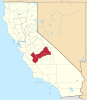
 Five Points Location in California  Five Points Five Points (the United States) | |
| Coordinates: 36°25′46″N 120°06′11″W / 36.42944°N 120.10306°W | |
| Country | United States |
| State | California |
| County | Fresno County |
| Elevation | 223 ft (68 m) |
| ZIP code | 93624[2] |
| Area code | 559 |
Five Points is an unincorporated community in Fresno County, California.[1] It is located 25 miles (40 km) northeast of Coalinga,[3] at an elevation of 223 feet (68 m).[1] Five Points marks the junction of California State Routes 145 and 269.
A post office opened at Five Points in 1944.[3] In 1978, it was said that "you can see all of Five Points from any point in Five Points", and that the town had around 100 residents, a cafe, and a few food and machinery supply businesses.[4] A few businesses remain as of 2025.
References
[edit]- ^ a b c U.S. Geological Survey Geographic Names Information System: Five Points, California
- ^ "Five Points ZIP Code". zipdatamaps.com. 2022. Retrieved November 11, 2022.
- ^ a b Durham, David L. (1998). California's Geographic Names: A Gazetteer of Historic and Modern Names of the State. Clovis, Calif.: Word Dancer Press. p. 1035. ISBN 1-884995-14-4.
- ^ Laughnan, Woody (May 7, 1978). "If you like elbow room, Five Points could be your town". The Fresno Bee. Fresno, CA. Retrieved January 16, 2025.
This Fresno County, California-related article is a stub. You can help Wikipedia by expanding it. |