Eldoradoville, California
Appearance
Eldoradoville | |
|---|---|
Former settlement | |
| Coordinates: 34°13′47″N 117°46′11″W / 34.2297°N 117.7698°W | |
| Country | United States |
| State | California |
| County | Los Angeles County |
| Established | 1859 |
| Washed away | 1862 |
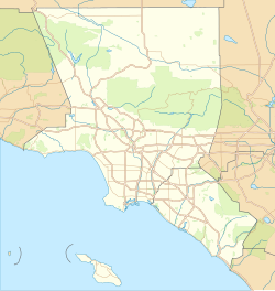
Eldoradoville was a gold mining town in Los Angeles County, located in the San Gabriel Mountains. Established in 1859, after gold had been discovered in the river in 1855, Eldoradoville at its peak population had three stores and six saloons.[1] It was washed away on January 18, 1862, in the Great Flood of 1862.[2][3] One historian described it as "the Downieville of the south—a rough and tough miner's town."[1]
The site of Eldoradoville is on the East Fork of the San Gabriel River, on the north side of East Fork Road, where the Eldoradoville Campground is located at an elevation of 1,866 feet (569 m).
See also
[edit]References
[edit]- ^ a b Gudde, Erwin G. (1975). California Gold Camps. University of California Press. pp. 107–108.
- ^ "The Great Floods of the San Gabriel Mountains" Archived 2008-04-26 at the Wayback Machine by Cecile Page Vargo, Explore Historic California, February 2005]
- ^ Federal Writers Project, David Kipen, Los Angeles in The 1930s: The WPA Guide to the City of Angels, University of California Press, 2011, p. 303
External links
[edit]- MICHAEL WARREN, California’s First Gold Rush from www.goldgold.com
- East Fork always wins in battle with man, San Bernardino Sun, 01/05/2009

