Eiger Glacier
| Eiger Glacier | |
|---|---|
| Eigergletscher | |
 The Eiger Glacier, passing between the Little Eiger and the Mönch | |
| Type | Alpine glacier, hanging glacier |
| Location | Lauterbrunnen, Bern, Switzerland |
| Coordinates | 46°34′02″N 7°59′20″E / 46.56722°N 7.98889°E[1] |
| Area | 1.54 km2 (0.59 sq mi)[2] |
| Length | 2.59 km (1.61 mi)[2] |
| Highest elevation | 3,700 m (12,100 ft) above sea level |
| Lowest elevation | 3,200 m (10,500 ft) above sea level |
| Status | Retreating |
 | |
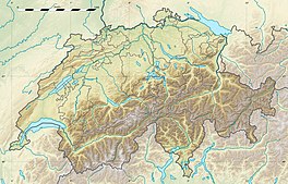
The Eiger Glacier (German: Eigergletscher) is a glacier situated on the north-west side of the Eiger in the Bernese Alps of Switzerland, within the municipality of Lauterbrunnen in the canton of Bern.[1] It extends from a height of 3,700 m (12,100 ft) above sea level behind the Little Eiger, a secondary peak to the west of the Eiger, and runs towards the valley in the direction of the Eigergletscher railway station. Another tongue, at 3,200 to 3,500 m (10,500 to 11,500 ft) above sea level, is in the form of a hanging glacier between the Eiger and Little Eiger.
The glacier is 2.59 km (1.61 mi) with an area of 1.54 km2 (0.59 sq mi), reduced from an area of 2.13 km2 (0.82 sq mi) recorded in 1973.[2] From 1993 to 2017 it retreated by around 500 m (1,600 ft) as the glacier melted.[2] In 1990, a large, continuous crack was discovered during a helicopter flight, leading the Research Institute for Hydraulic Engineering, Hydrology and Glaciology at ETH Zurich to begin research work, to gain knowledge about hanging glaciers and develop measures to protect the Jungfrau railway station. The threatened collapse occurred in 1990, but without causing any damage. Since then an automatic camera has taken a photo of the glacier every day.[3]

See also
[edit]References
[edit]- ^ a b Maps of Switzerland (Map). Swiss Confederation. 2025. Retrieved 2025-01-31.
- ^ a b c d "Factsheet: Eigergletscher". GLAMOS (Glacier Monitoring Switzerland). Retrieved 2025-01-31.
- ^ Krebs, Peter (2008). "Eisschlauch – Die eisige Westside-Story". In Anker, Daniel (ed.). Eiger – Die vertikale Arena (4th ed.). Zürich: AS Verlag.
External links
[edit]


