East Rochester, Ohio
East Rochester, Ohio | |
|---|---|
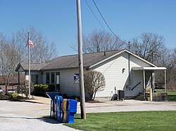
 East Rochester Post Office | |
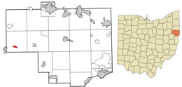
 Location of East Rochester in Columbiana County, Ohio. | |
| Coordinates: 40°45′02″N 81°02′28″W / 40.75056°N 81.04111°W | |
| Country | United States |
| State | Ohio |
| County | Columbiana |
| Township | West |
| Area | |
• Total | 0.43 sq mi (1.10 km2) |
| • Land | 0.43 sq mi (1.10 km2) |
| • Water | 0.00 sq mi (0.00 km2) |
| Elevation | 1,079 ft (329 m) |
| Population (2020) | |
• Total | 224 |
| • Density | 525.82/sq mi (202.93/km2) |
| Time zone | UTC-5 (Eastern (EST)) |
| • Summer (DST) | UTC-4 (EDT) |
| ZIP code | 44625 |
| Area code(s) | 330, 234 |
| FIPS code | 39-24024 |
| GNIS feature ID | 2628889[2] |
| School District | Minerva Local School District |
East Rochester is an unincorporated community and census-designated place in southern West Township, Columbiana County, Ohio, United States.[2] The population was 224 as of the 2020 census.[3] It lies along U.S. Route 30 about 20 miles (32 km) east of Canton, and has a post office with the ZIP code 44625.[4]
History
[edit]| Census | Pop. | Note | %± |
|---|---|---|---|
| 2010 | 231 | — | |
| 2020 | 224 | −3.0% | |
| U.S. Decennial Census[5] | |||
East Rochester was originally known officially as "Rochester", and under the latter name was platted in 1834.[6] The Cleveland and Pittsburgh Railroad was built through the settlement in 1852.[7] When the post office was established, the name "East Rochester" was adopted to avoid repetition with another Rochester, Ohio.[8] A post office called East Rochester has been in operation since 1840.[9]
Geography
[edit]East Rochester is located along U.S. Route 30, 32 miles (51 km) northwest of East Liverpool and 22 miles (35 km) east of Canton. The nearest incorporated community is Minerva, 4 miles (6 km) to the west.
According to the U.S. Census Bureau, the East Rochester CDP has an area of 0.42 square miles (1.1 km2).[10] It is in the valley of Sandy Creek, which flows west to the Tuscarawas River, a tributary of the Ohio River.
Education
[edit]Children in East Rochester are served by the Minerva Local School District. The current schools serving East Rochester are:
- Minerva Elementary School – – grades K-5
- Minerva Middle School – grades 6-8
- Minerva High School – grades 9-12
References
[edit]- ^ "ArcGIS REST Services Directory". United States Census Bureau. Retrieved September 20, 2022.
- ^ a b c U.S. Geological Survey Geographic Names Information System: East Rochester, Ohio
- ^ "East Rochester CDP, Ohio". U.S. Census Bureau. Retrieved March 24, 2022.
- ^ USPS – Cities by ZIP Code
- ^ "Census of Population and Housing". Census.gov. Retrieved August 18, 2022.
- ^ Overman, William Daniel (1958). Ohio Town Names. Akron, OH: Atlantic Press. p. 41.
- ^ McCord, William B. (1905). History of Columbiana County, Ohio and Representative Citizens. Biographical Publishing Company. pp. 314.
- ^ Mack, Horace (1879). History of Columbiana County, Ohio: With Illustrations and Biographical Sketches of Some of Its Prominent Men and Pioneers. Unigraphic. p. 291.
- ^ "Columbiana County". Jim Forte Postal History. Archived from the original on March 4, 2016. Retrieved January 10, 2016.
- ^ "Geographic Identifiers: 2010 Demographic Profile Data (G001): East Rochester CDP, Ohio". U.S. Census Bureau, American Factfinder. Archived from the original on January 24, 2015. Retrieved January 23, 2015.


