Draft:Sandbox/Innesw/Infobox Australian place-upgrade/testcases
Test cases for Template:Sandbox/Innesw/Infobox Australian place-upgrade (which calls Module:Sandbox/Innesw/Infobox Australian place-upgrade) for comparison with the original template at Template:Infobox Australian place.
Notes:
- This page is intended for testing of proposed changes to the Infobox code during development, and illustration of the changes after testing is complete
- Most cases are therefore specific to particular upgrade issues
- There are currently no tests of the short description or categories, as these are only processed in article namespace
- Testcases for the associated upgrade of the PopulationFromWikidata module are in the #Population Tests section
|type= and |state= errors
[edit]values not defined
[edit]| {{Infobox Australian place}} | {{Sandbox/Innesw/Infobox Australian place-upgrade}} | ||||||||||||||
|---|---|---|---|---|---|---|---|---|---|---|---|---|---|---|---|
|
| ||||||||||||||
invalid values
[edit]| {{Infobox Australian place}} | {{Sandbox/Innesw/Infobox Australian place-upgrade}} | ||||||||||||||
|---|---|---|---|---|---|---|---|---|---|---|---|---|---|---|---|
|
| ||||||||||||||
Map tests
[edit]Force LGA map: |use_lga_map=yes
[edit]Not Force LGA map: |use_lga_map=no
[edit]| {{Infobox Australian place}} | {{Sandbox/Innesw/Infobox Australian place-upgrade}} | ||||||||||||||||
|---|---|---|---|---|---|---|---|---|---|---|---|---|---|---|---|---|---|
|
| ||||||||||||||||
Force national map: |force_national_map=yes
[edit]| {{Infobox Australian place}} | {{Sandbox/Innesw/Infobox Australian place-upgrade}} | ||||||||||||||||
|---|---|---|---|---|---|---|---|---|---|---|---|---|---|---|---|---|---|
|
| ||||||||||||||||
Not Force national map: |force_national_map=no
[edit]| {{Infobox Australian place}} | {{Sandbox/Innesw/Infobox Australian place-upgrade}} | ||||||||||||||||
|---|---|---|---|---|---|---|---|---|---|---|---|---|---|---|---|---|---|
|
| ||||||||||||||||
Alternative location map: |alternative_location_map=<non blank>
[edit]| {{Infobox Australian place}} | {{Sandbox/Innesw/Infobox Australian place-upgrade}} | ||||||||||||
|---|---|---|---|---|---|---|---|---|---|---|---|---|---|
|
| ||||||||||||
Force relief map: |relief=yes
[edit]| {{Infobox Australian place}} | {{Sandbox/Innesw/Infobox Australian place-upgrade}} | ||||||||||||||||
|---|---|---|---|---|---|---|---|---|---|---|---|---|---|---|---|---|---|
|
| ||||||||||||||||
Not Force relief map: |relief=no
[edit]| {{Infobox Australian place}} | {{Sandbox/Innesw/Infobox Australian place-upgrade}} | ||||||||||||||||
|---|---|---|---|---|---|---|---|---|---|---|---|---|---|---|---|---|---|
|
| ||||||||||||||||
local map caption
[edit]| {{Infobox Australian place}} | {{Sandbox/Innesw/Infobox Australian place-upgrade}} | ||||||||||||||||
|---|---|---|---|---|---|---|---|---|---|---|---|---|---|---|---|---|---|
|
| ||||||||||||||||
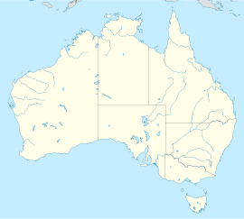
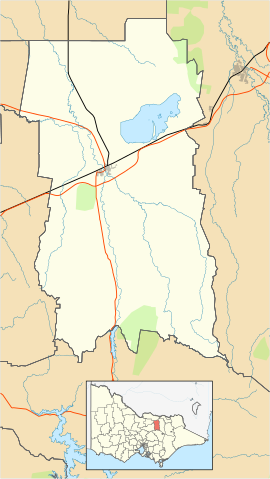
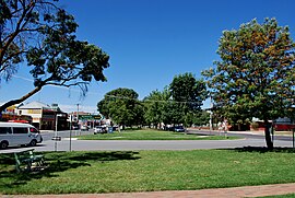
all possible images and maps
[edit]- the picture is set in
|image= - a specific location map, as used for LGAs, is set in
|image2= - the location map as the automatically-generated one (as
|type=is not 'lga') - the local map (showing the SAL boundary) is shown becaue
|local_map=yes
| {{Infobox Australian place}} | {{Sandbox/Innesw/Infobox Australian place-upgrade}} | ||||||||||||||||||||||||
|---|---|---|---|---|---|---|---|---|---|---|---|---|---|---|---|---|---|---|---|---|---|---|---|---|---|
|
| ||||||||||||||||||||||||
|type=townandlocality and |local_map=yes
[edit]- the local map (showing the SAL boundary) is shown because
|local_map=yes - the UCL boundary is also on the map because
|type=townandlocalityand a map file named 'Yea, Victoria UCL.map' exists in Commons:Data: At present this is the only map of a UCL in Commons:Data:.
| {{Infobox Australian place}} | {{Sandbox/Innesw/Infobox Australian place-upgrade}} | ||||||||||||||||||
|---|---|---|---|---|---|---|---|---|---|---|---|---|---|---|---|---|---|---|---|
|
| ||||||||||||||||||
Population Tests
[edit]Integrated wikidata population references between article text and infobox
[edit]This is an example article lede, with adjacent infobox (right aligned). Note the reference for the UCL population in the text is the same as that for the UCL population in the infobox.
| Yea Victoria | |
|---|---|
| Population | |
Yea is a town in Victoria. It has a population of 1,279[1].
|pop= and |pop2= both manual
[edit]| {{Infobox Australian place}} | {{Sandbox/Innesw/Infobox Australian place-upgrade}} | ||||||||||||||||||
|---|---|---|---|---|---|---|---|---|---|---|---|---|---|---|---|---|---|---|---|
|
| ||||||||||||||||||
|pop= blank (so from wikidata) and |pop2= manual
[edit]Also poprank shown after pop from wikidata.
| {{Infobox Australian place}} | {{Sandbox/Innesw/Infobox Australian place-upgrade}} | ||||||||||||||||||
|---|---|---|---|---|---|---|---|---|---|---|---|---|---|---|---|---|---|---|---|
|
| ||||||||||||||||||
|type=town and |pop= blank (so from wikidata)
[edit]Connected to the Ulladulla (Q649969) Wikidata item for testing purposes.
This has both UCL and SAL populations in wikidata.
| {{Infobox Australian place}} | {{Sandbox/Innesw/Infobox Australian place-upgrade}} | ||||
|---|---|---|---|---|---|
|
|
|type=city and |pop= blank (so from wikidata)
[edit]Connected to the Ulladulla (Q649969) Wikidata item for testing purposes.
This has both UCL and SAL populations in wikidata.
| {{Infobox Australian place}} | {{Sandbox/Innesw/Infobox Australian place-upgrade}} | ||||
|---|---|---|---|---|---|
|
|
|type=lga and |pop= blank (so from wikidata)
[edit]Connected to the City of Fremantle (Q1455046) Wikidata item for testing purposes.
| {{Infobox Australian place}} | {{Sandbox/Innesw/Infobox Australian place-upgrade}} | ||||
|---|---|---|---|---|---|
|
|
|type=town with Cosmo Newberry community Wikidata item
[edit]Connected to the Cosmo Newbery (Q5174266) Wikidata item for testing purposes.
This has both UCL and ILOC populations in wikidata.
| {{Infobox Australian place}} | {{Sandbox/Innesw/Infobox Australian place-upgrade}} | ||||
|---|---|---|---|---|---|
|
|
|type=city
[edit]Connected to the Darwin (Q11568) Wikidata item for testing purposes.
This has UCL, SUA, GCCSA and inter-census population estimates in wikidata.
| {{Infobox Australian place}} | {{Sandbox/Innesw/Infobox Australian place-upgrade}} | ||||
|---|---|---|---|---|---|
|
|
|type=suburb with odd Wikidata import
[edit]This test is for template type = suburb.
Connected to the Colongra (Q5148194) Wikidata item for testing purposes.
This has a zero value population in wikidata.
| {{Infobox Australian place}} | {{Sandbox/Innesw/Infobox Australian place-upgrade}} | ||||
|---|---|---|---|---|---|
|
|
Response to wikidata items with claims with two dates
[edit]Connected to the Banksiadale (Q4856763) Wikidata item for testing purposes.
This had a zero value population in two consecutive censuses, so the two claims are merged in wikidata.
| {{Infobox Australian place}} | {{Sandbox/Innesw/Infobox Australian place-upgrade}} | ||||
|---|---|---|---|---|---|
|
|
Showing new function for historic populations
[edit]Connected to the Ulladulla (Q649969) Wikidata item for testing purposes.
| UCL | SAL | |
|---|---|---|
| 2006 | 10,298[28] | 6,242[27] |
| 2011 | 12,137[26] | 6,070[25] |
| 2016 | 13,054[30] | 6,615[29] |
| 2021 | 14,396[7] | 7,262[8] |
Showing new function for historic populations, with |geog=ucl
[edit]Connected to the Ulladulla (Q649969) Wikidata item for testing purposes.
| UCL | |
|---|---|
| 2006 | 10,298[28] |
| 2011 | 12,137[26] |
| 2016 | 13,054[30] |
| 2021 | 14,396[7] |
Other Tests
[edit]logo caption
[edit]| {{Infobox Australian place}} | {{Sandbox/Innesw/Infobox Australian place-upgrade}} | ||||||||||||||||||
|---|---|---|---|---|---|---|---|---|---|---|---|---|---|---|---|---|---|---|---|
|
| ||||||||||||||||||
background of sub-table headings
[edit]| {{Infobox Australian place}} | {{Sandbox/Innesw/Infobox Australian place-upgrade}} | ||||||||||||||||||||||||||||||||||||||||||||||||||||||||||||||
|---|---|---|---|---|---|---|---|---|---|---|---|---|---|---|---|---|---|---|---|---|---|---|---|---|---|---|---|---|---|---|---|---|---|---|---|---|---|---|---|---|---|---|---|---|---|---|---|---|---|---|---|---|---|---|---|---|---|---|---|---|---|---|---|
|
| ||||||||||||||||||||||||||||||||||||||||||||||||||||||||||||||
References
[edit]- ^ a b c Australian Bureau of Statistics (28 June 2022). "Yea (urban centre and locality)". 2021 Census QuickStats.
- ^ a b Australian Bureau of Statistics (28 June 2022). "Yea (suburb and locality)". 2021 Census QuickStats. Retrieved 28 June 2022.
- ^ Australian Bureau of Statistics (28 June 2022). "Yea (Suburbs and Localities)". 2021 Census QuickStats. Retrieved 2023-04-11.
- ^ a b Australian Bureau of Statistics (27 June 2017). "Yea (State Suburbs)". 2016 Census QuickStats. Retrieved 2023-04-11.
- ^ Australian Bureau of Statistics (28 June 2022). "Yea (urban centre and locality)". Australian Census 2021.
- ^ Australian Bureau of Statistics (28 June 2022). "Ulladulla (urban centre and locality)". Australian Census 2021.
- ^ a b c d Australian Bureau of Statistics (28 June 2022). "Ulladulla (urban centre and locality)". 2021 Census QuickStats.
- ^ a b Australian Bureau of Statistics (28 June 2022). "Ulladulla (suburb and locality)". 2021 Census QuickStats. Retrieved 28 June 2022.
- ^ Australian Bureau of Statistics (28 June 2022). "Ulladulla (urban centre and locality)". Australian Census 2021.
- ^ Australian Bureau of Statistics (28 June 2022). "Fremantle (Local Government Area)". Australian Census 2021 QuickStats. Retrieved 28 June 2022.
- ^ Australian Bureau of Statistics (28 June 2022). "Fremantle (Local Government Area)". 2021 Census QuickStats. Retrieved 28 June 2022.
- ^ Australian Bureau of Statistics (28 June 2022). "Cosmo Newberry (Indigenous Location)". Australian Census 2021 QuickStats. Retrieved 28 June 2022.
- ^ Australian Bureau of Statistics (28 June 2022). "Cosmo Newbery (suburb and locality)". Australian Census 2021 QuickStats. Retrieved 28 June 2022.
- ^ Australian Bureau of Statistics (28 June 2022). "Cosmo Newberry (Indigenous Location)". 2021 Census QuickStats. Retrieved 28 June 2022.
- ^ Australian Bureau of Statistics (28 June 2022). "Cosmo Newbery (suburb and locality)". 2021 Census QuickStats. Retrieved 28 June 2022.
- ^ Australian Bureau of Statistics (28 June 2022). "Darwin (urban centre and locality)". Australian Census 2021.
{{cite web}}:|access-date=requires|url=(help); Missing or empty|url=(help) - ^ Australian Bureau of Statistics (28 June 2022). "Darwin (urban centre and locality)". Australian Census 2021.
- ^ Australian Bureau of Statistics (28 June 2022). "Darwin (urban centre and locality)". 2021 Census QuickStats.
- ^ Australian Bureau of Statistics (27 June 2017). "Colongra (suburb and locality)". Australian Census 2016.
- ^ Australian Bureau of Statistics (27 June 2017). "Colongra (suburb and locality)". Australian Census 2016 QuickStats. Retrieved 28 June 2022.
- ^ Australian Bureau of Statistics (28 June 2022). "Colongra (suburb and locality)". 2021 Census QuickStats. Retrieved 28 June 2022.
- ^ Australian Bureau of Statistics (27 June 2017). "Banksiadale (suburb and locality)". Australian Census 2016.
- ^ Australian Bureau of Statistics (27 June 2017). "Banksiadale (suburb and locality)". Australian Census 2016 QuickStats. Retrieved 28 June 2022.
- ^ Australian Bureau of Statistics (28 June 2022). "Banksiadale (suburb and locality)". 2021 Census QuickStats. Retrieved 28 June 2022.
- ^ Australian Bureau of Statistics (31 October 2012). "Ulladulla (suburb and locality)". 2011 Census QuickStats.
- ^ a b Australian Bureau of Statistics (31 October 2012). "Ulladulla (urban centre and locality)". 2011 Census QuickStats.
- ^ Australian Bureau of Statistics (25 October 2007). "Ulladulla (suburb and locality)". 2006 Census QuickStats.
- ^ a b Australian Bureau of Statistics (25 October 2007). "Ulladulla (urban centre and locality)". 2006 Census QuickStats.
- ^ Australian Bureau of Statistics (27 June 2017). "Ulladulla (suburb and locality)". 2016 Census QuickStats.
- ^ a b Australian Bureau of Statistics (27 June 2017). "Ulladulla (urban centre and locality)". 2016 Census QuickStats.
- ^ a b "Alexandra Monthly Temperatures". Commonwealth of Australia, Bureau of Meteorology. Retrieved 2012-08-10.
- ^ "Yea Monthly Rainfall". Commonwealth of Australia, Bureau of Meteorology. Retrieved 2012-08-10.


