Dos de Mayo province
Appearance
Dos de Mayo | |
|---|---|
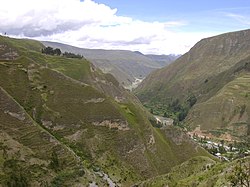
 Urqumayu valley | |
 Location of Dos de Mayo in the Huánuco Region | |
| Country | Peru |
| Region | Huánuco |
| Founded | November 5, 1870 |
| Capital | La Unión |
| Government | |
| • Mayor | Luis Maldonado Rivera (2019–2022) |
| Area | |
• Total | 1,438.88 km2 (555.55 sq mi) |
| Elevation | 3,226 m (10,584 ft) |
| Population | |
• Total | 33,258 |
| • Density | 23/km2 (60/sq mi) |
| UBIGEO | 1003 |
| Website | Official Website |
Dos de Mayo (literally May 2) is one of eleven provinces of the Huánuco Region in Peru. The capital of this province is the city of La Unión.
Boundaries
[edit]- North: province of Huamalíes
- East: province of Leoncio Prado
- South: provinces of Huánuco, Yarowilca and Lauricocha
- West: Ancash Region
Geography
[edit]Some of the highest mountains of the province are listed below:[1]
- Allqa Raqra
- Allqay
- Aquy P'itiq
- Chuskuqucha
- Hanka Punta
- Hanka Wasi
- Hatun Punta
- Hatun P'unqu
- Hirka Kancha
- Kimsa Qucha
- Kinwa Qucha
- Kunkayuq
- Kushuru
- Khuchi Mach'ay
- Mama Hirka
- Maray
- Millpu Punta
- Pampa Wasi
- Pinqullu
- Pishtaq Punta
- Puchka Punta
- Puka Hirka
- Puka Raqra
- Phiruruyuq Punta
- P'itiq
- Qisqi Punta
- Qiwlla Qucha
- Quchayuq Punta
- Quriqucha
- Raqra Punta
- Riku Hirka
- Rumi Sunqu
- Rupha Pampa
- Saqra Waqra
- Saqsa Kusma
- Tikti Punta
- Tinku Pampa Punta
- Tuna Kancha
- Tutu Punta
- Ukru Wayin
- Waka Mach'ay Punta
- Wamalla Punta
- Wamash Punta
- Wank'a Mayu
- Wank'a Ukru Punta
- Wayta Hirka Punta
- Winchus
- Wiru Wiru
- Yana Mach'ay
- Yana Phaqcha
- Yuraq Yaku
- Yuraq Yaku Punta
Political division
[edit]The province is divided into nine districts, which are:
Ethnic groups
[edit]The province is inhabited by indigenous citizens of Quechua descent. Spanish, however, is the language which the majority of the population (59.82%) learnt to speak in childhood, 39.87% of the residents started speaking using the Quechua language (2007 Peru Census).[2]
See also
[edit]References
[edit]- ^ escale.minedu.gob.pe - UGEL map of the province of Dos de Mayo (Huánuco Region)
- ^ inei.gob.pe Archived January 27, 2013, at the Wayback Machine INEI, Peru, Censos Nacionales 2007
9°49′59″S 76°40′08″W / 9.833°S 76.669°W
