Dobřany (Rychnov nad Kněžnou District)
Dobřany | |
|---|---|
 Church of Saint Nicholas | |
| Coordinates: 50°19′20″N 16°17′7″E / 50.32222°N 16.28528°E | |
| Country | |
| Region | Hradec Králové |
| District | Rychnov nad Kněžnou |
| First mentioned | 1361 |
| Area | |
• Total | 4.06 km2 (1.57 sq mi) |
| Elevation | 630 m (2,070 ft) |
| Population (2024-01-01)[1] | |
• Total | 131 |
| • Density | 32/km2 (84/sq mi) |
| Time zone | UTC+1 (CET) |
| • Summer (DST) | UTC+2 (CEST) |
| Postal code | 518 01 |
| Website | www |
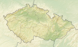
Dobřany (German: Dobschan) is a municipality and village in Rychnov nad Kněžnou District in the Hradec Králové Region of the Czech Republic. It has about 100 inhabitants.
Etymology
[edit]The name is derived from the Czech adjective dobrá (i.e. 'good'). It referred to good (fertile) land.[2]
Geography
[edit]Dobřany is located about 17 kilometres (11 mi) north of Rychnov nad Kněžnou and 33 km (21 mi) east of Hradec Králové. It lies in the Orlické Foothills. The highest point is a nameless hill at 775 m (2,543 ft) above sea level. The Dědina River flows along the western municipal border.
History
[edit]The first written mention of Dobřany is from 1361. Until the establishment of a sovereign municipality in 1848, the village belonged to the Opočno estate.[2]
Demographics
[edit]
|
|
| ||||||||||||||||||||||||||||||||||||||||||||||||||||||
| Source: Censuses[3][4] | ||||||||||||||||||||||||||||||||||||||||||||||||||||||||
Transport
[edit]There are no railways or major roads passing through the municipality.
Sights
[edit]
The main landmark of Dobřany is the Church of Saint Nicholas. It was built in the Baroque style in 1738–1740 on the site of an older church.[5]
A cultural monument is also the nearby rectory, dating from 1776. The wooden house is an example of local folk architecture. At the beginning of the 19th century, the patriotic priest Josef Liboslav Ziegler worked here. The rectory then became an important regional centre of the Czech National Revival, where notable personalities met, such as Josef Dobrovský, František Vladislav Hek and Magdalena Dobromila Rettigová. Today the house serves as a recreational facility.[6]
On a hill above the Dědina River in the western part of the municipality there is a ruin of the Dobřany Castle. The castle was founded at the end of the 13th century at the earliest, but more likely at the beginning of the 14th century. No written records have been preserved about the castle. It was probably abandoned already in the 14th century and disappeared during the Hussite Wars in 1425, when it was conquered by the Orebites. It was a two-part bergfried-type castle. It is a tourist destination, but only a little of the castle has survived to this day.[7]
References
[edit]- ^ "Population of Municipalities – 1 January 2024". Czech Statistical Office. 2024-05-17.
- ^ a b "Dějiny Dobřan" (in Czech). Obec Dobřany. Retrieved 2024-12-03.
- ^ "Historický lexikon obcí České republiky 1869–2011" (in Czech). Czech Statistical Office. 2015-12-21.
- ^ "Population Census 2021: Population by sex". Public Database. Czech Statistical Office. 2021-03-27.
- ^ "Kostel sv. Mikuláše s ohrazením" (in Czech). National Heritage Institute. Retrieved 2024-12-03.
- ^ "Fara" (in Czech). National Heritage Institute. Retrieved 2024-12-03.
- ^ "Hrad, zřícenina" (in Czech). National Heritage Institute. Retrieved 2024-12-03.


