Dindefelo
Appearance
Dindéfelo
Dinndéfélou | |
|---|---|
Town | |
| Coordinates: 12°23′0″N 12°19′0″W / 12.38333°N 12.31667°W | |
| Country | |
| Region | Kédougou Region |
| Department | Kédougou |
| Arrondissement | Bandafassi Arrondissement |
| Elevation | 405 m (1,332 ft) |
| Time zone | UTC+0 (GMT) |
| [1] | |
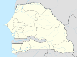
Dindéfelo (var. Dinndéfélou) is a village near Segou in southeast Senegal. It is home to the tourist attraction and park at Dindefelo Falls which can be reached by following a creek-side trail to the south. The town is 38 km southeast of Kedougou, 6 km from the town of Segou Senegal, and was historically a part of Kedougou kingdom in the Senegalese foothills of the Fouta Djallon mountains.[2] The region is traditionally home to the Bassari people.[3]
References
[edit]- ^ Dinndefelou, Senegal Page[dead link]. Falling Rain Genomics, Inc. 1996-2004. Accessed 2009-06-06.
- ^ *Andrew Burke, David Else. The Gambia & Senegal. Lonely Planet, (2002) ISBN 1-74059-137-2. p. 291-92
- ^ Bulletin de l'Institut fondamental d'Afrique noire:1970. Institut fondamental d'Afrique noire. p. 560, 562, 563.

