Damphu, Tsirang
Appearance
This article needs additional citations for verification. (March 2015) |
You can help expand this article with text translated from the corresponding article in Spanish. (November 2024) Click [show] for important translation instructions.
|
Damphu | |
|---|---|
Town | |
 | |
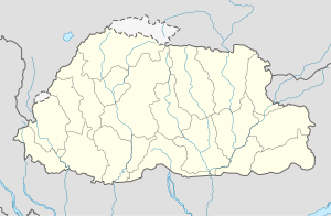
| Coordinates: 27°01′N 90°06′E / 27.017°N 90.100°E | |
| Country | |
| District | Tsirang District |
| Population (2005) | |
• Total | 1,666 |
| Time zone | UTC+6 (BTT) |
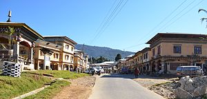
Damphu is the administrative headquarters and capital of Tsirang District, Bhutan.[1] It is located on the north–south highway running from Wangdue Phodrang to Sarpang and Gelephu on the border with India. It contains the Tsirang Dzong. At the 2005 census, its population was 1,666.
Climate
[edit]| Climate data for Damphu, Tsirang District, elevation 1,520 m (4,990 ft), (1996–2017 normals) | |||||||||||||
|---|---|---|---|---|---|---|---|---|---|---|---|---|---|
| Month | Jan | Feb | Mar | Apr | May | Jun | Jul | Aug | Sep | Oct | Nov | Dec | Year |
| Record high °C (°F) | 20.5 (68.9) |
22.0 (71.6) |
25.0 (77.0) |
27.5 (81.5) |
28.0 (82.4) |
28.0 (82.4) |
28.5 (83.3) |
29.5 (85.1) |
28.5 (83.3) |
28.5 (83.3) |
25.0 (77.0) |
22.5 (72.5) |
29.5 (85.1) |
| Mean daily maximum °C (°F) | 14.4 (57.9) |
16.0 (60.8) |
18.9 (66.0) |
21.1 (70.0) |
22.6 (72.7) |
23.4 (74.1) |
23.5 (74.3) |
24.0 (75.2) |
23.5 (74.3) |
22.0 (71.6) |
19.2 (66.6) |
16.3 (61.3) |
20.4 (68.7) |
| Daily mean °C (°F) | 9.6 (49.3) |
11.3 (52.3) |
14.4 (57.9) |
17.3 (63.1) |
19.4 (66.9) |
20.9 (69.6) |
21.3 (70.3) |
21.5 (70.7) |
20.7 (69.3) |
17.9 (64.2) |
14.4 (57.9) |
11.3 (52.3) |
16.7 (62.0) |
| Mean daily minimum °C (°F) | 4.7 (40.5) |
6.6 (43.9) |
9.8 (49.6) |
13.4 (56.1) |
16.2 (61.2) |
18.4 (65.1) |
19.1 (66.4) |
18.9 (66.0) |
17.8 (64.0) |
13.8 (56.8) |
9.5 (49.1) |
6.3 (43.3) |
12.9 (55.2) |
| Record low °C (°F) | 0.5 (32.9) |
−0.5 (31.1) |
3.0 (37.4) |
7.0 (44.6) |
10.5 (50.9) |
12.5 (54.5) |
13.5 (56.3) |
13.8 (56.8) |
13.5 (56.3) |
6.5 (43.7) |
4.5 (40.1) |
−1.0 (30.2) |
−1.0 (30.2) |
| Average rainfall mm (inches) | 9.2 (0.36) |
15.2 (0.60) |
39.5 (1.56) |
69.9 (2.75) |
120.9 (4.76) |
312.2 (12.29) |
460.6 (18.13) |
341.0 (13.43) |
207.1 (8.15) |
106.4 (4.19) |
1.8 (0.07) |
5.0 (0.20) |
1,688.8 (66.49) |
| Average relative humidity (%) | 73.4 | 74.0 | 71.3 | 75.8 | 82.3 | 88.0 | 90.8 | 89.0 | 86.0 | 79.4 | 75.9 | 73.4 | 79.9 |
| Source: National Center for Hydrology and Meteorology[2] | |||||||||||||
References
[edit]- ^ "Google Maps".
- ^ "Climate Data Book of Bhutan, 2018" (PDF). National Center for Hydrology and Meteorology. Retrieved 20 February 2025.

