Cumanacoa
Appearance
Cumanacoa | |
|---|---|
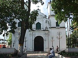
 Cumanacoa church | |
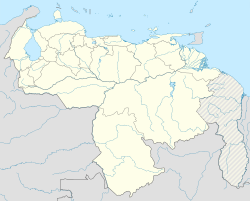
| Coordinates: 10°15′2″N 63°55′11″W / 10.25056°N 63.91972°W | |
| Country | |
| State | Sucre |
| Municipality | Montes |
| Time zone | UTC-4:30 (VST) |
| • Summer (DST) | UTC-4:30 (not observed) |
| Postal code | 6106 |
Cumanacoa is a town in the state of Sucre, Venezuela. It is the capital of the Montes Municipality.
In 2012 Hurricane Isaac caused heavy rain in the area and the Manzanares River overflowed its banks in the town of Cumanacoa inundating approximately 1,200 homes many of which were damaged and a few destroyed.[1] Some residents had to be airlifted to safety. Similar flooding occurred elsewhere in the country, such as in Caracas where 40 families had to be evacuated.[2]
References
[edit]- ^ "Tormenta tropical 'Isaac' deja dos muertos en Venezuela". Reuters (in Spanish). Noticieros Televisa. August 25, 2012. Retrieved November 22, 2012.
- ^ "Tropical storm lashes Isaac Venezuela". El Universal. August 27, 2012. Retrieved November 22, 2012.
External links
[edit] Media related to Cumanacoa at Wikimedia Commons
- Crecida rio Manzanares Cumanacoa 2012

