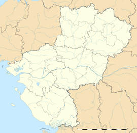
Couesmes-Vaucé
Appearance
Couesmes-Vaucé | |
|---|---|
 Overall view of the village of Vaucé | |
| Coordinates: 48°27′09″N 0°42′30″W / 48.4525°N 0.7083°W | |
| Country | France |
| Region | Pays de la Loire |
| Department | Mayenne |
| Arrondissement | Mayenne |
| Canton | Gorron |
| Government | |
| • Mayor (2020–2026) | Emmanuel Dorsy[1] |
Area 1 | 19.13 km2 (7.39 sq mi) |
| Population (2022)[2] | 377 |
| • Density | 20/km2 (51/sq mi) |
| Time zone | UTC+01:00 (CET) |
| • Summer (DST) | UTC+02:00 (CEST) |
| INSEE/Postal code | 53079 /53300 |
| Elevation | 100–206 m (328–676 ft) (avg. 150 m or 490 ft) |
| 1 French Land Register data, which excludes lakes, ponds, glaciers > 1 km2 (0.386 sq mi or 247 acres) and river estuaries. | |
Couesmes-Vaucé (French pronunciation: [kwɛm vose]) is a commune in the Mayenne department in north-western France. It was created in 1973 by the merger of two former communes: Couesmes-en-Froulay and Vaucé.[3]
Couesmes-Vaucé is a small commune, with only 300 properties and as of the 2019 census 378 inhabitants.
Couesmes-Vaucé is close to both Normandy and Brittany and lies roughly 50 miles from the surrounding cities of Rennes, Caen and Le Mans. The village is situated in the heart of an agricultural region noted for its good food and cider.
There is a thriving and well integrated English community that has been established over the past thirty years.
See also
[edit]References
[edit]- ^ "Répertoire national des élus: les maires" (in French). data.gouv.fr, Plateforme ouverte des données publiques françaises. 13 September 2022.
- ^ "Populations de référence 2022" (in French). The National Institute of Statistics and Economic Studies. 19 December 2024.
- ^ Modifications aux circonscriptions administratives territoriales (fusion de communes), Journal officiel de la République française n° 0256, 1 November 1972, p. 11407.
Wikimedia Commons has media related to Couesmes-Vaucé.


