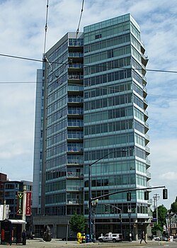
Civic Tower (Portland, Oregon)
Appearance
| Civic Tower | |
|---|---|
 The building in 2014 | |
 | |
| General information | |
| Town or city | Portland, Oregon |
| Country | United States |
| Coordinates | 45°31′21″N 122°41′26″W / 45.5226°N 122.6905°W |
The Civic Tower is a high-rise building located at 1926 West Burnside Street in Portland, Oregon, United States. Construction began in 2005, and was completed in 2007.[1]
References
[edit]- ^ "The Civic Tower". Emporis. Archived from the original on May 17, 2018. Retrieved May 16, 2018.
External links
[edit]
