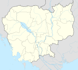
Chheu Teal
Appearance
Chheu Teal
ឃុំ ឈើទាល | |
|---|---|
| Coordinates: 13°1′N 103°10′E / 13.017°N 103.167°E | |
| Country | |
| Province | Battambang Province |
| District | Banan District |
| Villages | 15 |
| Time zone | UTC+07 |
| Geocode | 20104 |
Chheu Teal (Khmer: ឃុំ ឈើទាល) is a khum (commune) of Banan District in Battambang Province in north-western Cambodia.[1]
Villages
[edit]Chheu Teal contains fifteen villages.[2]
| Name | Khmer | Population (1998) | Village code |
|---|---|---|---|
| Kampong Chhlang | កំពង់ឆ្លង | 2010401 | |
| Chheu Teal | ឈើទាល | 2010402 | |
| Kampong Srama | កំពង់ស្រម៉ | 2010403 | |
| Khnar | ខ្នារ | 2010404 | |
| Enteak Chit | ឥន្ទជិត | 2010405 | |
| Bat Sala | បត់សាលា | 2010406 | |
| Bay Damram | បាយដំរាំ | 2010407 | |
| Svay Prakeab | ស្វាយប្រគាប | 2010408 | |
| Chhak Pou | ឆកពោធិ៍ | 2010409 | |
| Anlong Ta Mei | អន្លង់តាម៉ី | 2010410 | |
| Chamkar Svay | ចំការស្វាយ | 2010411 | |
| Thkov | ថ្កូវ | 2010412 | |
| Baboh | បបុះ | 2010413 | |
| Doung | ដូង | 2010414 | |
| Anlok Kaong | អន្លក់កោង | 2010415 |
References
[edit]- ^ "Statistics of the Cambodian Government". Archived from the original on 2008-12-24.
- ^ "National Institute of Statistics (NIS), Phnom Penh - Cambodia".[permanent dead link]


