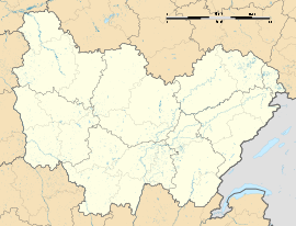
Chastellux-sur-Cure
Appearance
Chastellux-sur-Cure | |
|---|---|
 The town hall in Chastellux-sur-Cure | |
| Coordinates: 47°23′13″N 3°53′18″E / 47.3869°N 3.8883°E | |
| Country | France |
| Region | Bourgogne-Franche-Comté |
| Department | Yonne |
| Arrondissement | Avallon |
| Canton | Avallon |
| Government | |
| • Mayor (2020–2026) | Gérard Paillard[1] |
Area 1 | 10.55 km2 (4.07 sq mi) |
| Population (2022)[2] | 131 |
| • Density | 12/km2 (32/sq mi) |
| Time zone | UTC+01:00 (CET) |
| • Summer (DST) | UTC+02:00 (CEST) |
| INSEE/Postal code | 89089 /89630 |
| Elevation | 210–397 m (689–1,302 ft) |
| 1 French Land Register data, which excludes lakes, ponds, glaciers > 1 km2 (0.386 sq mi or 247 acres) and river estuaries. | |
Chastellux-sur-Cure (French pronunciation: [ʃatly syʁ kyʁ], literally Chastellux on Cure) is a commune in the Yonne department in Bourgogne-Franche-Comté in north-central France.
The Chateau de Chastellux, the ancestral home of the Chastellux family, is visitable every day after 10 am except Monday and Tuesday ( tel: 06-76-75-83-71 or 08-86-34-20-03 ). It is still owned by descendants of Marquis de Chastellux who was second in command ( 1780 to 1782) to the Comte de Rochambeau who led the French military contingent during the American War of Independence.
See also
[edit]References
[edit]
- ^ "Répertoire national des élus: les maires" (in French). data.gouv.fr, Plateforme ouverte des données publiques françaises. 13 September 2022.
- ^ "Populations de référence 2022" (in French). The National Institute of Statistics and Economic Studies. 19 December 2024.
Wikimedia Commons has media related to Chastellux-sur-Cure.


