Cassilândia
Appearance
Cassilândia | |
|---|---|
| The Municipality of Cassilândia | |
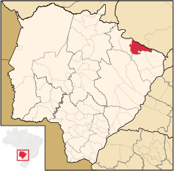
 Location of Cassilândia | |
| Coordinates: 19°06′46″S 51°44′02″W / 19.11278°S 51.73389°W | |
| Country | |
| Region | Central-West |
| State | |
| Government | |
| • Mayor | José Donizete (PT) |
| Area | |
• Total | 3,649.83 km2 (2,267.899 sq mi) |
| Elevation | 470 m (1.542 ft) |
| Population (2020 [1]) | |
• Total | 22,002 |
| • Density | 5.9/km2 (3.6/sq mi) |
| Time zone | UTC−4 (AMT) |
| Postal Code | 59540-000 |
| HDI (PNUD/2000) | 0.775 – medium |
| Website | Cassilândia, Mato Grosso do Sul |
Cassilândia is a municipality located in the Brazilian state of Mato Grosso do Sul. Its population was 22,002 (2020) and its area is 3,650 km2.
References
[edit]Cassilândia is located in the northeastern part of the state, in the border with Goiás State and is surrounded by beautiful landscapes. It has an international airport and two universities, a private and a state one. The city is known by its famous rodeo party which takes place in late July, early August.

