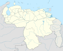
Casigua-El Cubo
Appearance
You can help expand this article with text translated from the corresponding article in Spanish. (August 2018) Click [show] for important translation instructions.
|
Casigua-El Cubo | |
|---|---|
| Coordinates: 08°44′42″N 072°31′11″W / 8.74500°N 72.51972°W | |
| Country | Venezuela |
| State | Zulia |
| Counties | Jesús María Semprún |
| Founded | 13 December 1913 |
| Area | |
• Total | 6,003 km2 (2,318 sq mi) |
| Elevation | 3 m (9 ft) |
| Population (2011) | |
• Total | 30,484 |
| • Density | 5.078/km2 (13.15/sq mi) |
| Time zone | UTC−4 (VET) |
| Postal code | 5063 |
| Area code | (+58) 275 |
Casigua-El Cubo is the seat of the Jesús María Semprún municipality, within the Zulia State in northwestern Venezuela. It is located in the south of the Lake Maracaibo, on the banks of the Tarra River.
Transport
[edit]The city is served by the El Cubo Airport (IATA: CUV, ICAO: SVCG).
References
[edit]- Casigua El Cubo
- Emilio Strauss, William Fuenmayor, José Romero.(2000). Atlas del Estado Zulia.


