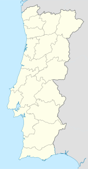
Caparica
Caparica | |
|---|---|
| Coordinates: 38°39′50″N 9°12′00″W / 38.664°N 9.200°W | |
| Country | |
| Region | Lisbon |
| Metropolitan area | Lisbon |
| District | Setúbal |
| Municipality | Almada |
| Disbanded | 2013 |
| Area | |
• Total | 11.02 km2 (4.25 sq mi) |
| Population (2011) | |
• Total | 20,454 |
| • Density | 1,900/km2 (4,800/sq mi) |
| Time zone | UTC+00:00 (WET) |
| • Summer (DST) | UTC+01:00 (WEST) |
| Postal code | P-2825 |
| Website | www.jf-caparica.pt |
Caparica is a former civil parish in the municipality (concelho) of Almada, Lisbon metropolitan area, Portugal. In 2013, the parish merged with the civil parish of Trafaria into the new parish Caparica e Trafaria.[1] The population in 2011 was 20,454,[2] in an area of 11.02 km2.[3]
Location
[edit]Caparica is situated on the Setúbal Peninsula, south of the Tagus River. On the opposite bank of the Tagus lies Belém, a civil parish of Lisbon. Caparica lies west of the central part of Almada Municipality and west of the 25 de Abril Bridge.
History
[edit]The name Caparica is probably derived from the Latin word capparis, which means caper. Caparica may have been founded during the Roman conquest of the Iberian Peninsula. It became a parish in 1472, and it became a town on September 27, 1985.
Localities
[edit]The parish of Caparica includes the following localities:
- Vila Nova de Caparica
- Capuchos
- Funchalinho
- Areeiro
- Granja
- Fómega
- Alcaniça
- Raposo
- Pera
- Monte de Caparica
- Torre
- Fonte Santa
- Serrado
- Pilotos
- Costas de Cão
- Banática
- Porto Brandão
- Lazarim
Points of interest
[edit]- Convent of the Capuchins
- Church of Nossa Senhora do Monte de Caparica
- Forte de São Sebastião da Caparica
References
[edit]- ^ Diário da República. "Law nr. 11-A/2013, page 552 10" (PDF) (in Portuguese). Retrieved 8 July 2014.
- ^ Instituto Nacional de Estatística
- ^ Eurostat


