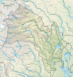
Brommafjorden
Tools
Actions
General
Print/export
In other projects
Appearance
From Wikipedia, the free encyclopedia
Part of the hallindal river
| Brommafjorden | |
|---|---|
| Location | Nesbyen (Buskerud) |
| Coordinates | 60°33′3″N 9°8′32″E / 60.55083°N 9.14222°E / 60.55083; 9.14222 |
| Basin countries | Norway |
| Surface area | 3.16 km2 (1.22 sq mi) |
| Shore length1 | 27.21 km (16.91 mi) |
| Surface elevation | 152 m (499 ft) |
| References | NVE |
| 1 Shore length is not a well-defined measure. | |
Brommafjorden is a lake in the municipality of Nesbyen in Buskerud county, Norway. Brommafjorden is part of the Hallingdal River (Hallingdalselva). This is possibly the widest and most quiet part of the Hallingdal River. Brommafjorden was the site of Bromma station, a now-defunct rail station on the Bergen Railway. It was opened in 1907 when Bergen Railway was opened to Gulsvik and was operated until 1984. [1] [2]
See also
[edit]References
[edit]Retrieved from "http://en.wiki.x.io/w/index.php?title=Brommafjorden&oldid=1202021688"
Hidden categories:
- Pages using gadget WikiMiniAtlas
- Articles with short description
- Short description is different from Wikidata
- Coordinates on Wikidata
- Articles using infobox body of water without image
- Articles using infobox body of water without pushpin map alt
- Articles using infobox body of water without image bathymetry
- All stub articles

