Brive–Laroche Airport
Appearance
Brive–La Roche Airport Aérodrome de Brive – La Roche | |||||||||||
|---|---|---|---|---|---|---|---|---|---|---|---|
 | |||||||||||
| Summary | |||||||||||
| Airport type | Public | ||||||||||
| Operator | Communauté d'Agglomération de Brive | ||||||||||
| Serves | Brive-la-Gaillarde, France | ||||||||||
| Elevation AMSL | 379 ft / 116 m | ||||||||||
| Coordinates | 45°08′59″N 001°28′28″E / 45.14972°N 1.47444°E | ||||||||||
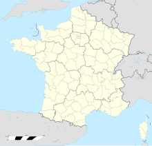
| Map | |||||||||||
 | |||||||||||
| Runways | |||||||||||
| |||||||||||
Source: French AIP[1] | |||||||||||
Brive–La Roche Airport or Aérodrome de Brive – La Roche (IATA: BVE, ICAO: LFBV) was an airport located 3.5 kilometres (1.9 NM) west of Brive-la-Gaillarde,[1] a commune of the Corrèze department in the Nouvelle-Aquitaine region of France.
History
[edit]As of February 2011, the aerodrome is due for closure, and only accepts locally based planes.[2] A new airport known as Brive–Souillac Airport or Brive–Dordogne Valley Airport (French: Aéroport Brive – Vallée de la Dordogne, 45°02′23″N 001°29′08″E / 45.03972°N 1.48556°E) opened on June 15, 2010.[3] The Airlinair (now HOP!) flights to and from Paris–Orly airport have been transferred to this new airport[4] as have all other passenger services.
References
[edit]- ^ a b LFBV – Brive La Roche. AIP from French Service d'information aéronautique, effective 26 December 2024.
- ^ "LFBV – Brive la Roche". Navigeo. Archived from the original on 2011-07-27. Retrieved 2 July 2011.
- ^ Home-page – Air&Cosmos [dead link]. Air-cosmos.com. Retrieved on 2011-06-15.
- ^ "Destinations: Brive". Airlinair. Archived from the original on 16 July 2011. Retrieved 2 July 2011.
External links
[edit]- Aérodrome de Brive-Laroche at Communauté d'Agglomération de Brive (in French)
- Accident history for BVE / LFBV: Brive-la-Gaillarde–Laroche Airport at Aviation Safety Network

