Bonah Aliyari
Bonah Aliyari
Persian: بنه علي ياري | |
|---|---|
Village | |
| Coordinates: 31°01′22″N 50°29′27″E / 31.02278°N 50.49083°E[1] | |
| Country | Iran |
| Province | Kohgiluyeh and Boyer-Ahmad |
| County | Landeh |
| District | Mugarmun |
| Rural District | Vahdat |
| Population (2016)[2] | |
• Total | 187 |
| Time zone | UTC+3:30 (IRST) |
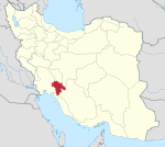
Bonah Aliyari (Persian: بنه علي ياري)[a] is a village in Vahdat Rural District, Mugarmun District, Landeh County, Kohgiluyeh and Boyer-Ahmad province, Iran.
Demographics
[edit]Population
[edit]At the time of the 2006 National Census, the village's population was 233 in 46 households, when it was in Tayebi-ye Garmsiri-ye Shomali Rural District of the former Landeh District of Kohgiluyeh County.[4] The following census in 2011 counted 231 people in 45 households.[5] The 2016 census measured the population of the village as 187 people in 48 households, by which time the district had been separated from the county in the establishment of Landeh County. The rural district was transferred to the new Central District, and Bonah Aliyari was transferred to Vahdat Rural District created in the new Mugarmun District.[6] It was the most populous village in its rural district.[2]
See also
[edit]Notes
[edit]References
[edit]- ^ OpenStreetMap contributors (26 December 2024). "Bonah Aliyari, Landeh County" (Map). OpenStreetMap (in Persian). Retrieved 26 December 2024.
- ^ a b Census of the Islamic Republic of Iran, 1395 (2016): Kohgiluyeh and Boyer-Ahmad Province. amar.org.ir (Report) (in Persian). The Statistical Center of Iran. Archived from the original (Excel) on 2 November 2021. Retrieved 19 December 2022.
- ^ "INCSGN Search". Iranian National Committee for Standardization of Geographical Names (in Persian). Tehran: National Cartographic Center of Iran. Archived from the original on 2 May 2019.[dead link]
- ^ Census of the Islamic Republic of Iran, 1385 (2006): Kohgiluyeh and Boyer-Ahmad Province. amar.org.ir (Report) (in Persian). The Statistical Center of Iran. Archived from the original (Excel) on 20 September 2011. Retrieved 25 September 2022.
- ^ Census of the Islamic Republic of Iran, 1390 (2011): Kohgiluyeh and Boyer-Ahmad Province. irandataportal.syr.edu (Report) (in Persian). The Statistical Center of Iran. Archived from the original (Excel) on 19 January 2023. Retrieved 19 December 2022 – via Iran Data Portal, Syracuse University.
- ^ Rahimi, Mohammadreza (c. 2023) [Approved 29 September 1391]. Carrying out national divisions in Kohgiluyeh and Boyer-Ahmad province. qavanin.ir (Report) (in Persian). Ministry of the Interior. Proposal 42/1/131105/42/1390. Archived from the original on 14 August 2023. Retrieved 14 August 2023 – via Laws and Regulations Portal of the Islamic Republic of Iran.


