Bezonvaux
Appearance
This article needs additional citations for verification. (February 2014) |
Bezonvaux | |
|---|---|
 The church in Bezonvaux | |
| Coordinates: 49°14′15″N 5°28′06″E / 49.2375°N 5.4683°E | |
| Country | France |
| Region | Grand Est |
| Department | Meuse |
| Arrondissement | Verdun |
| Canton | Belleville-sur-Meuse |
| Intercommunality | CA Grand Verdun |
Area 1 | 9.23 km2 (3.56 sq mi) |
| Population (2022)[1] | 0 |
| • Density | 0.0/km2 (0.0/sq mi) |
| Time zone | UTC+01:00 (CET) |
| • Summer (DST) | UTC+02:00 (CEST) |
| INSEE/Postal code | 55050 /55400 |
| Elevation | 226–367 m (741–1,204 ft) (avg. 257 m or 843 ft) |
| 1 French Land Register data, which excludes lakes, ponds, glaciers > 1 km2 (0.386 sq mi or 247 acres) and river estuaries. | |
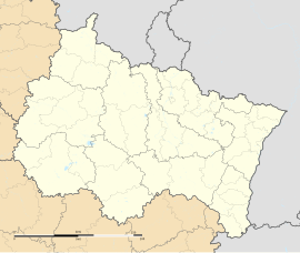
Bezonvaux (French pronunciation: [bəzɔ̃vo]) is a commune in the Meuse department in the Grand Est region in northeastern France.
History
[edit]Since the end of the Battle of Verdun in 1916, it has been unoccupied (official population: 0) along with Beaumont-en-Verdunois, Haumont-près-Samogneux, Louvemont-Côte-du-Poivre, Cumières-le-Mort-Homme and Fleury-devant-Douaumont.
-
Historical photo of Bezonvaux
-
State after 9 August 1916
During the war, the town was destroyed and the land was made uninhabitable to such an extent that a decision was made not to rebuild it. The site of the commune is maintained as a testimony to war and is officially designated as a "village that died for France". It is managed by a municipal council of three members appointed by the prefect of the Meuse department.
See also
[edit]- Zone rouge (First World War)
- List of French villages destroyed in World War I
- Communes of the Meuse department
References
[edit]- ^ "Populations de référence 2022" (in French). The National Institute of Statistics and Economic Studies. 19 December 2024.
Wikimedia Commons has media related to Bezonvaux.


