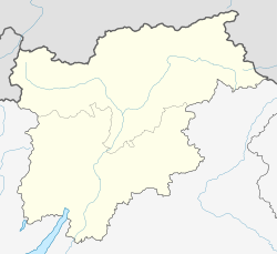
Barbian
Barbian | |
|---|---|
| Gemeinde Barbian Comune di Barbiano | |
 Parish church of Saint James | |
| Coordinates: 46°36′N 11°31′E / 46.600°N 11.517°E | |
| Country | Italy |
| Region | Trentino-Alto Adige/Südtirol |
| Province | Bolzano (BZ) |
| Frazioni | Kollmann (Colma), St. Gertraud (Santa Gertrude), Saubach |
| Government | |
| • Mayor | Erich Mur |
| Area | |
• Total | 24.4 km2 (9.4 sq mi) |
| Elevation | 836 m (2,743 ft) |
| Population (November 2010)[2] | |
• Total | 1,601 |
| • Density | 66/km2 (170/sq mi) |
| Demonyms | German: Barbianer Italian: Barbianesi |
| Time zone | UTC+1 (CET) |
| • Summer (DST) | UTC+2 (CEST) |
| Postal code | 39040 |
| Dialing code | 0471 |
| Website | Official website |
Barbian (German: [ˈbarbi̯aːn]; Italian: Barbiano [barˈbjaːno]) is a comune (municipality) and a village in South Tyrol in northern Italy, located about 15 kilometres (9 mi) northeast of Bolzano.
Geography
[edit]As of 30 November 2010, it had a population of 1,601 and an area of 24.4 square kilometres (9.4 sq mi).[3]
Barbian borders the following municipalities: Kastelruth, Lajen, Waidbruck, Ritten, and Villanders.
Frazioni
[edit]The municipality of Barbian contains the frazioni (subdivisions, mainly villages and hamlets) Kollmann (Colma), St. Gertraud (Santa Gertrude), Saubach.
History
[edit]Place-name
[edit]The dwelling is mentioned for the first time in 994 as Parpian, the name deriving probably from the Latin personal name Barbius,[4] a name also attested in Venetic inscriptions from the Roman era.
Coat-of-arms
[edit]The shield is tierced per fess in argent, vert and sable. In the second level are represented three churches: St. Nicholas, St. Gertrude and St. Magdalene, which are located in the mountains above the village. The sable bottom is crossed by a thin band of argent and gules, symbolizing the customs bar of the village of Kollmann sited in the municipality. The arms were granted in 1970.[5]
Society
[edit]Linguistic distribution
[edit]According to the 2024 census, 97.53% of the population speak German, 1.87% Italian and 0.60% Ladin as first language.
|
Demographic evolution
[edit]
References
[edit]- ^ "Superficie di Comuni Province e Regioni italiane al 9 ottobre 2011". Italian National Institute of Statistics. Retrieved 16 March 2019.
- ^ "Popolazione Residente al 1° Gennaio 2018". Italian National Institute of Statistics. Retrieved 16 March 2019.
- ^ All demographics and other statistics: Italian statistical institute Istat.
- ^ Nomi d'Italia. Novara: Istituto Geografico De Agostini. 2004.
- ^ Heraldry of the World: Barbian
- ^ Oscar Benvenuto (ed.): "South Tyrol in Figures 2008", Provincial Statistics Institute of the Autonomous Province of South Tyrol, Bozen/Bolzano 2007, p. 16, table 10
- ^ "Volkszählung 2011/Censimento della popolazione 2011". astat info (38). Provincial Statistics Institute of the Autonomous Province of South Tyrol: 6–7. June 2012. Retrieved 2012-06-14.
- ^ "Ergebnisse Sprachgruppenzählung 2024/Risultati Censimento linguistico 2024". astat info (56). Provincial Statistics Institute of the Autonomous Province of South Tyrol. December 2024. Retrieved 2024-12-09.
External links
[edit]![]() Media related to Barbian at Wikimedia Commons
Media related to Barbian at Wikimedia Commons
- (in German and Italian) Homepage of the municipality


