Ballydavid
This article needs additional citations for verification. (May 2021) |
Ballydavid
Baile na nGall | |
|---|---|
Village | |
 | |
| Coordinates: 52°13′12″N 10°21′39″W / 52.2201149°N 10.3608993°W | |
| Country | Ireland |
| Province | Munster |
| County | County Kerry |
| Official name: Baile na nGall. | |
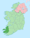
Baile na nGall (Irish, meaning "town of the foreigners),[1] unofficially anglicized as "Ballydavid", is a Gaeltacht village is situated on the Dingle Peninsula of County Kerry, Ireland. As the 2003 Official Languages Act revoked the status of the English language name Ballydavid, the official name is Baile na nGall.[2]
The village is near to Gallarus Castle, a 15th-century tower built by the Knight of Kerry, the holder of a hereditary knighthood belonging to the Geraldine Dynasty.[3] It is now an Irish heritage site and stands about one kilometre from the better known and more historically significant Gallarus Oratory.
RTÉ Raidió na Gaeltachta has a broadcast studio just outside the village.[4] The radio tower is also a transmission site for RTÉ Network Limited.
The Marilyn, Ballydavid Head, has a relative height of 247 metres.
See also
[edit]References
[edit]- ^ Placenames Database of Ireland
- ^ "Official Languages Act 2003". Irish Statute Book. electronic Irish Statute Book (eISB). Retrieved 6 June 2024.
- ^ Anonymous 1846, p. 228: "Gallerus or Gollerus, a village, and a cluster of curious antiquities, near the head of Smerwick Harbour, parish of Kilmelehedor, barony of Corkaguiney, County Kerry, Munster. The antiquities are a curious hermitage, a tower .. and a castle which belonged to the Fitzgeralds, Knights of Kerry ..."
- ^ O´Connell, Peter (29 March 2022). "Raidió na Gaeltachta: 10 shows that defined a station across five decades". Irish Examiner. Retrieved 6 June 2024.
Sources
[edit]- Anonymous (1846). The Parliamentary Gazetteer of Ireland. Vol. 2. Dublin: A. Fullarton. – D to M (for Gallerus)


