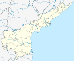
Attili
Appearance
Attili | |
|---|---|
 Dynamic map | |
| Coordinates: 16°42′00″N 81°36′00″E / 16.7000°N 81.6000°E | |
| Country | |
| State | Andhra Pradesh |
| District | West Godavari |
| Talukas | Attili |
| Elevation | 11 m (36 ft) |
| Population (2011) | |
• Total | 25,004 |
| Languages | |
| • Official | Telugu |
| Time zone | UTC+5:30 (IST) |
| PIN | 534134 |
| Vehicle registration | AP |
Attili is a town in West Godavari district of the Indian state of Andhra Pradesh.[1] It belongs to Tanuku Constituency in Tadepalligudem revenue division. Attili has its own train station. Attili is the headquarters of Attili mandal.The pincode is 534134
Demographics
[edit]As of 2011[update] Census of India, Attili had a population of 25,004. The total population constitutes 12,509 males and 12,495 females with a sex ratio of 999 females per 1,000 males. 2,315 children are in the age group of 0–6 years, with a sex ratio of 928. The average literacy rate stands at 78.82%.[2]
References
[edit]- ^ "Mandal wise list of villages in West Godavari district" (PDF). Chief Commissioner of Land Administration. National Informatics Centre. Archived from the original (PDF) on 8 February 2015. Retrieved 8 March 2016.
- ^ "Attili Population Census". Retrieved 17 May 2017.


