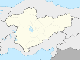
Ata, Yenimahalle
Appearance
This article needs additional citations for verification. (September 2022) |
Ata | |
|---|---|
| Coordinates: 40°00′27″N 32°37′03″E / 40.00750°N 32.61750°E | |
| Country | Turkey |
| Province | Ankara |
| District | Yenimahalle |
| Population (2022) | 28,886 |
| Time zone | UTC+3 (TRT) |
Ata is a neighbourhood in the municipality and district of Yenimahalle, Ankara Province, Turkey.[1] Its population is 28,886 (2022).[2]
The name of the neighborhood was determined by the decision of the residents of the neighborhood by a referendum. It means forefather".[3]
Although there is no neighborhood in it, it is intertwined with the neighborhood of Eryaman, which is the district of Etimesgut.
Infrastructure and transportation
[edit]There are many cooperatives and settlements in the neighborhood.
EGO buses depart from Eryaman 1-2 Metro Station to the neighborhood. There is also an EGO bus from the center of Sincan District. Local minibuses connected to Eryaman station also depart from Ulus.[4][5]
Population
[edit]| Year | Pop. | ±% p.a. |
|---|---|---|
| 2017 | 22,996 | — |
| 2022 | 28,886 | +4.67% |
| Source: TÜIK (2007-2022)[2] | ||
References
[edit]- ^ Mahalle, Turkey Civil Administration Departments Inventory. Retrieved 22 May 2023.
- ^ a b "Population Of Municipalities, Villages And Quarters". TÜIK. Retrieved 2 July 2023.
- ^ "What does ata mean in Turkish?". Retrieved 21 September 2022.
- ^ "A T A MAHALLESİ, Yenimahalle nerede, Otobüs veya Metro ile nasıl gidilir?". moovitapp.com.
- ^ "549 Sincan – Fatih Metro İstasyonu – Ata Mh. – Şeyh Şamil Mh. hattı güzergahı yeniden düzenlenmiştir". EGO Genel Müdürlüğü.


